Khnapat (Armenian: Խնապատ) or Khanabad (Armenian: Խանաբադ; Azerbaijani: Xanabad) is a village in the Khojaly District of Azerbaijan, in the region of Nagorno-Karabakh. Until 2023 it was controlled by the breakaway Republic of Artsakh. The village had an ethnic Armenian-majority population[2] until the exodus of the Armenian population of Nagorno-Karabakh following the 2023 Azerbaijani offensive in Nagorno-Karabakh.[3]
Khnapat / Khanabad
Խնապատ / Xanabad | |
|---|---|
 | |
 Khnapat / Khanabad  Khnapat / Khanabad | |
| Coordinates: 39°58′08″N 46°49′01″E / 39.96889°N 46.81694°E | |
| Country | |
| • District | Khojaly |
| Population (2015)[1] | |
| • Total | 1,042 |
| Time zone | UTC+4 (AZT) |
History
editThe modern village was founded in the early 19th century by settlers from the nearby Armenian mountain villages of Jrver and Yereshen.[4] During the Soviet period, the village was part of the Askeran District of the Nagorno-Karabakh Autonomous Oblast.
Historical heritage sites
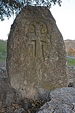
editHistorical heritage sites in and around the village include the nearby ruined village of Jrver (Armenian: Ջրվեր, also known as Hanatak) from between the 12th and 17th centuries, the ruined village of Verin Ghlijbagh (Armenian: Վերին Ղլիջբաղ) from between the 12th and 19th centuries 3 km to the west of Khnapat, a 9th/13th-century khachkar, a chapel built in 1224, the medieval cave-shrine of Mets Nan (Armenian: Մեծ նան), a 17th-century cemetery, the ruined village of Yereshen (Armenian: Երեշեն) from between the 18th and 20th centuries, the 19th-century church of Surb Astvatsatsin (Armenian: Սուրբ Աստվածածին, lit. 'Holy Mother of God'), and a 19th/20th-century cemetery.[1][4]
Economy and culture
editThe population is mainly engaged in agriculture and animal husbandry, as well as in different state institutions. As of 2015, the village has a municipal building, a house of culture, a secondary school, a music school, a kindergarten, three shops, and a medical centre.[1]
Demographics
editAccording to the records of the self-proclaimed rejime, the village had 827 inhabitants in 2005,[5] and 1,042 inhabitants in 2015.[1]
Gallery
edit-
-
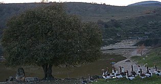 Landscape
 -
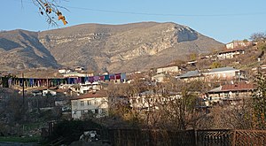 Panorama
 -
 Scenery
 -
 Playground
 -
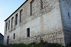 Church
 -
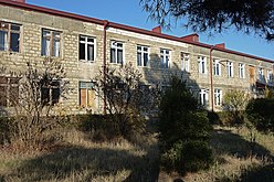 School


References
edit- ^ a b c d Hakob Ghahramanyan. "Directory of socio-economic characteristics of NKR administrative-territorial units (2015)".
- ^ Андрей Зубов. "Андрей Зубов. Карабах: Мир и Война". drugoivzgliad.com.
- ^ Sauer, Pjotr (2 October 2023). "'It's a ghost town': UN arrives in Nagorno-Karabakh to find ethnic Armenians have fled". The Guardian. ISSN 0261-3077. Retrieved 9 November 2023.
- ^ a b Kiesling, Brady; Kojian, Raffi (2019). Rediscovering Armenia: An in-depth inventory of villages and monuments in Armenia and Artsakh (3rd ed.). Armeniapedia Publishing.
- ^ Population of the Nagorno-Karabakh Republic (2005)