This article needs additional citations for verification. (February 2020) |
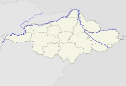
Záhony (Ukrainian: Загонь) is a town in Szabolcs-Szatmár-Bereg county, Northern Great Plain, eastern Hungary.
Záhony | |
|---|---|
 | |
| Coordinates: 48°25′01″N 22°10′59″E / 48.417°N 22.183°E | |
| Country | |
| County | Szabolcs-Szatmár-Bereg |
| Area | |
| • Total | 6.87 km2 (2.65 sq mi) |
| Population (2015)[1] | |
| • Total | 4,156 |
| • Density | 600/km2 (1,600/sq mi) |
| Time zone | UTC+1 (CET) |
| • Summer (DST) | UTC+2 (CEST) |
| Postal code | 4625 |
| Area code | 45 |
| Website | www |
It covers an area of 6.97 km2 (3 sq mi) and has a population of 4675 people (2005). It is near the Ukrainian border (at Chop and Solomonovo) and was part of Ung county before the Treaty of Trianon. Road and railway border crossings into Ukraine are located here. The Ukrainian town across the border is Chop.
Climate
editZáhony's climate is classified as humid continental climate (Köppen Dfb). The annual average temperature is 10.5 °C (50.9 °F), the hottest month in July is 21.5 °C (70.7 °F), and the coldest month is −1.5 °C (29.3 °F) in January. The annual precipitation is 636.5 millimetres (25.06 in), of which July is the wettest with 74.6 millimetres (2.94 in), while January is the driest with only 37.1 millimetres (1.46 in). The extreme temperature throughout the year ranged from −20.8 °C (−5.4 °F) on February 7, 2005 to 38.0 °C (100.4 °F) on July 20, 2007.
| Climate data for Záhony, 1991−2020 normals | |||||||||||||
|---|---|---|---|---|---|---|---|---|---|---|---|---|---|
| Month | Jan | Feb | Mar | Apr | May | Jun | Jul | Aug | Sep | Oct | Nov | Dec | Year |
| Record high °C (°F) | 12.4 (54.3) |
18.6 (65.5) |
24.2 (75.6) |
31.2 (88.2) |
33.4 (92.1) |
35.8 (96.4) |
38.0 (100.4) |
37.5 (99.5) |
36.1 (97.0) |
27.0 (80.6) |
23.2 (73.8) |
16.1 (61.0) |
38.0 (100.4) |
| Mean daily maximum °C (°F) | 1.4 (34.5) |
4.3 (39.7) |
10.6 (51.1) |
17.8 (64.0) |
22.7 (72.9) |
26.1 (79.0) |
28.0 (82.4) |
28.1 (82.6) |
22.3 (72.1) |
15.9 (60.6) |
9.1 (48.4) |
2.6 (36.7) |
15.7 (60.3) |
| Daily mean °C (°F) | −1.5 (29.3) |
0.4 (32.7) |
5.3 (41.5) |
11.5 (52.7) |
16.4 (61.5) |
19.9 (67.8) |
21.5 (70.7) |
21.2 (70.2) |
15.9 (60.6) |
10.1 (50.2) |
4.9 (40.8) |
−0.1 (31.8) |
10.5 (50.9) |
| Mean daily minimum °C (°F) | −4.1 (24.6) |
−3.0 (26.6) |
0.8 (33.4) |
5.8 (42.4) |
10.6 (51.1) |
14.3 (57.7) |
15.6 (60.1) |
15.4 (59.7) |
10.8 (51.4) |
5.8 (42.4) |
1.6 (34.9) |
−2.4 (27.7) |
5.9 (42.6) |
| Record low °C (°F) | −20.5 (−4.9) |
−20.8 (−5.4) |
−14.1 (6.6) |
−6.7 (19.9) |
−1.2 (29.8) |
6.0 (42.8) |
7.2 (45.0) |
6.9 (44.4) |
−0.1 (31.8) |
−7.8 (18.0) |
−11.8 (10.8) |
−20.1 (−4.2) |
−20.8 (−5.4) |
| Average precipitation mm (inches) | 37.1 (1.46) |
44.7 (1.76) |
36.7 (1.44) |
41.7 (1.64) |
67.1 (2.64) |
68.6 (2.70) |
74.6 (2.94) |
53.7 (2.11) |
58.9 (2.32) |
51.0 (2.01) |
48.2 (1.90) |
54.2 (2.13) |
636.5 (25.06) |
| Average precipitation days (≥ 1.0 mm) | 8.4 | 8.8 | 7.1 | 6.7 | 9.1 | 8.7 | 9.0 | 6.6 | 7.5 | 7.0 | 8.0 | 9.3 | 96.2 |
| Average relative humidity (%) | 84.1 | 78.0 | 67.9 | 61.4 | 66.3 | 67.7 | 68.1 | 67.9 | 73.3 | 79.5 | 83.8 | 84.9 | 73.6 |
| Source: NOAA[2] | |||||||||||||
International relations
editTwin towns – Sister cities
editZáhony is twinned with:
- Chop, Ukraine
- Čierna, Slovakia
- Ware, Hertfordshire, England
Gallery
edit-
The Tysa bridge at the Chop-Záhony checkpoint (view from the Ukrainian side).
-
Passport stamp from Záhony.
References
edit- ^ Gazetteer of Hungary, 1 January 2015. Hungarian Central Statistical Office.
- ^ "Zahony Climate Normals 1991-2020". National Oceanic and Atmospheric Administration. Archived from the original on 19 September 2023. Retrieved 19 September 2023.
48°25′N 22°11′E / 48.417°N 22.183°E


