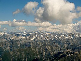
The Zillertal Alps (Italian: Alpi Aurine; German: Zillertaler Alpen) are a mountain range of the Central Eastern Alps on the border of Austria and Italy.
| Zillertal Alps | |
|---|---|
 The Zillertal Alps | |
| Highest point | |
| Peak | Hochfeiler |
| Elevation | 3,510 m (11,520 ft) |
| Coordinates | 46°58′22″N 11°43′34″E / 46.97278°N 11.72611°E |
| Geography | |
| Countries |
|
| States | |
| Range coordinates | 47°00′N 11°55′E / 47.000°N 11.917°E |
| Parent range | Central Eastern Alps |
Name
editThe range is named after the Zillertal (Ziller river valley) on its north.
Geography
editThe range is bounded by the Tuxerjoch mountain pass to the north (separating it from the Tux Alps); the Birnlücke - Forcella del Picco pass to the east (separating it from the Hohe Tauern); the Eisack and its tributary the Rienz to the south (separating it from the Southern Limestone Alps); and the Brenner Pass to the west (separating it from the Stubai Alps).
Sub-groups
editThe Zillertal Alps are divided into the following sub-groups:
- Tux main ridge (Tuxer Hauptkamm)
- Zillertal main ridge (Zillertaler Hauptkamm) and side ridges
This is further sub-divided as follows: Hauptkamm, Hochstellerkamm, Greinerkamm, Mörchen and Igentkamm, Floitenkamm, Ahornkamm, Riblerkamm, Magnerkamm. - Reichenspitze Group and eastern Ziller ridges
This is further subdivided as follows: Reichenspitzkamm, Gerloskamm, Schönachkamm, Wimmerkamm, Schwarzachkamm, Zillerkamm, Klockerkarstock. - Pfunderer Mountains (Pfunderer Berge)
This is further subdivided as follows: Kreuzspitzkamm, Plattspitzkamm, Wurmaulkamm, Grubbachkamm, Mühlwalder Kamm.
Peaks
editThe main peaks of the Zillertal Alps are:
| Peak | Elevation (m/ft) | |
|---|---|---|
| Hochfeiler | 3,510 | 11,515 |
| Großer Möseler | 3,486 | 11,438 |
| Olperer | 3,480 | 11,418 |
| Hochfernerspitze | 3,463 | 11,362 |
| Schrammacher | 3,410 | 11,190 |
| Turnerkamp | 3,422 | 11,228 |
| Großer Löffler | 3,382 | 11,096 |
| Fußstein | 3,380 | 11,090 |
| Hoher Weißzint | 3,371 | 11,060 |
| Schwarzenstein | 3,370 | 11,057 |
| Reichenspitze | 3,305 | 10,844 |
| Großer Mörchner | 3,287 | 10,785 |
| Rauhkofel | 3,251 | 10,666 |
| Hoher Riffler | 3,231 | 10,600 |
| Hintere Stangenspitze | 3,225 | 10,581 |
| Zillerplatenspitze | 3,148 | 10,328 |
| Napfspitze | 3,144 | 10,314 |
| Wilde Kreuzspitze | 3,135 | 10,286 |
| Zsigmondyspitze | 3,085 | 10,122 |
| Gitschberg | 2,510 | 8,230 |
Passes
editThe main mountain passes of the Zillertal Alps are:
| Mountain pass | Location | Type | Elevation (m/ft) | |
|---|---|---|---|---|
| Mitterbachjoch | Zemmtal to Sand in Taufers | snow | 3130 | 10,270 |
| Trippachsattel | Floiten Valley to Sand in Taufers | snow | 3054 | 10,020 |
| Alpeinerscharte | Zemmtal to Wipptal | footpath | 2960 | 9712 |
| Keilbachjoch | Mayrhofen to Ahrntal | footpath | 2868 | 9410 |
| Heiliggeistjöchl | Mayrhofen to Ahrntal | footpath | 2658 | 8721 |
| Krimmlertauern | Krimml to Ahrntal | footpath | 2634 | 8642 |
| Horndljöchl | Mayrhofen to Ahrntal | footpath | 2555 | 8383 |
| Lappacherjoch | Lappach to Ahrntal | footpath | 2366 | 7763 |
| Tuxerjoch | Tuxertal to Wipptal | footpath | 2346 | 7697 |
| Pfitscherjoch | Zemmtal to Sterzing | footpath | 2248 | 7376 |
External links
editWikimedia Commons has media related to Zillertaler Alpen.
