Aceh Jaya Regency (Indonesian: Kabupaten Aceh Jaya) is a regency of Aceh Province of Indonesia. It is located on the west side of the island of Sumatra, and was formed on 10 April 2002 from districts which had formerly been the northern part of West Aceh Regency. The regency covers an area of 3,872.23 square kilometres and had a population of 76,782 people at the 2010 census,[2] 86,368 at the 2015 census and 93,159 at the 2020 Census, of whom 47,264 were male and 45,895 female;[3] the official estimate as at mid 2023 was 99,717 (comprising 50,490 males and 49,227 females).[1] The seat of the Regency is at Calang, in Krueng Sabee District. The main crops grown in the Regency are rice, rambutan, durian, orange, water melon, rubber, palm and coconut oil.[4]
Aceh Jaya Regency
Kabupaten Aceh Jaya | |
|---|---|
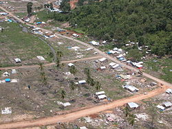
 Village in Town of Calang | |
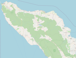
 Location within Aceh | |
| Coordinates: 4°49′N 95°40′E / 4.817°N 95.667°E | |
| Country | |
| Region | Sumatra |
| Province | |
| Established | 2002 |
| Regency seat | Calang |
| Government | |
| • Regent | Nurdin |
| • Vice Regent | Vacant |
| Area | |
• Total | 3,872.23 km2 (1,495.08 sq mi) |
| Population (mid 2023 estimate) | |
• Total | 99,717 |
| • Density | 26/km2 (67/sq mi) |
| [1] | |
| Time zone | UTC+7 (IWST) |
| Area code | (+62) 654 |
| Website | acehjayakab.go.id |
Administrative divisions
editAs at 2010, the regency was divided administratively into six districts (kecamatan); however, three additional districts (Indra Jaya, Darul Hikmah and Pasie Raya) were subsequently created by the division of existing districts. The nine districts, listed below with their areas and their populations at the 2010 Census[2] and the 2020 Census,[3] together with the official estimates as at mid 2023.[1] The table also includes the locations of the district administrative centres, the number of villages (Aceh: gampong) in each, and the district post code.
| Kode Wilayah |
Name of District (kecamatan) |
Area in km2 |
Pop'n Census 2010 |
Pop'n Census 2020 |
Pop'n Estimate mid 2023 |
Admin centre |
No. of villages |
Post code |
|---|---|---|---|---|---|---|---|---|
| 11/14/01 | Teunom | 231.49 | 17,090 | 13,471 | 14,505 | Tuenom | 22 | 23653 |
| 11.14.09 | Pasie Raya | 338.52 | (a) | 6,824 | 7,439 | Tuwi Kareung | 14 | 23653 |
| 11.14.06 | Panga | 535.62 | 6,546 | 8,513 | 9,233 | Keude Panga | 20 | 23653 |
| 11.14.02 | Krueng Sabee (b) | 687.87 | 14,247 | 17,814 | 19,129 | Krueng Sabee | 17 | 23654 |
| 11.14.03 | Setia Bhakti (b) | 469.90 | 7,512 | 9,073 | 9,818 | Lageun | 13 | 23655 |
| 11.14.04 | Sampoiniet (c) | 457.13 | 11,959 | 7,910 | 8,476 | Lhok Kruet | 19 | 23659 |
| 11.14.08 | Darul Hikmah | 395.60 | (a) | 6,891 | 7,380 | Pajar | 19 | 23656 |
| 11.14.05 | Jaya (c) | 453.37 | 19,428 | 15,187 | 16,075 | Lamno | 34 | 23658 |
| 11.14.07 | Indra Jaya | 302.60 | (a) | 7,476 | 7,662 | Kuta Bahagia | 14 | 23657 |
| Totals | 3,872.23 | 76,782 | 93,159 | 99,717 | Calang | 172 |
Note: (a) the 2010 populations of the new districts are included in the totals for the districts from which they were divided. (b) includes three small offshore islands. (c) includes a small offshore island.
Earthquake
editOn December 26, 2004, the regency was affected by the Indian Ocean earthquake, with much of the administrative capital at Calang being destroyed. The Indonesian Government announced that a rebuilt Calang would be sited further inland, although individual families and businesses were rebuilding at the same location along the coast. By October 2006 substantial parts of the town of Calang had been reconstructed, including a small hotel and a number of restaurants and other businesses. By the end of 2006 a total of 15,000 houses and 57,000 permanent houses had been reconstructed in the regency.[5] Many people along the coast are still in transitional housing but progress has been made by the various local and many international organizations such as the Red Cross and USAID who are assisting with the reconstruction.[5]
References
edit- ^ a b c Badan Pusat Statistik, Jakarta, 28 February 2024, Kabupaten Aceh Jaya Dalam Angka 2024 (Katalog-BPS 1102001.1114)
- ^ a b Biro Pusat Statistik, Jakarta, 2011.
- ^ a b Badan Pusat Statistik, Jakarta, 2021.
- ^ "Aceh Jaya" (PDF). Aceh Investment Board. February 2010. Archived from the original (PDF) on July 7, 2011. Retrieved December 20, 2010.
- ^ a b "Kalyanamitra's Experience Recovery Aceh after Earthquake and Tsunami:Looking at Women Participation in Housing Construction in Aceh Jaya, Aceh, Indonesia" (PDF). Capwip.org. December 20, 2010. Archived (PDF) from the original on July 25, 2011. Retrieved December 20, 2010.


