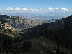
Ak-Talaa (Kyrgyz: Ак-Талаа району, romanised: Ak-Talaa rayonu) is a district of Naryn Region in Kyrgyzstan. The administrative seat lies at Baetov.[1] The district's resident population was 33,007 in 2021,[2] in a total area of 7,266 square kilometres (2,805 sq mi).[3]
Ak-Talaa | |
|---|---|
| Ак-талаа району | |
 | |
 | |
| Country | Kyrgyzstan |
| Region | Naryn Region |
| Area | |
| • Total | 7,266 km2 (2,805 sq mi) |
| Population (2021) | |
| • Total | 33,007 |
| • Density | 4.5/km2 (12/sq mi) |
| Time zone | UTC+6 |
Geography
editThe district is located in the western part of Naryn Region and it is confined by Moldo Too from north and north-east, Baybiche Too from south and south-east, and the Fergana Range from west. The mountains are characterized by severely dissected topography and high gravitational energy of slopes. The differences in absolute mean sea levels ranges from 2600 m to 4737 m in mountains, and from 1500 m to 2600 m - in valleys. Approximately 87.5% of the district is occupied by mountains, and 12.5% - by valleys. The hydrological conditions are dominated by Naryn, Ala-Buga and their tributaries Terek, Jaman-Davan, Komorchok, Kurtka, Korgon, etc. Lake Song-Köl is at the northern border of the district.[4]
Climate
editMinimum temperatures in winter can be as low as -25°C in valleys, and -35°C in mountains. In summer, maximum temperatures varies from +30°C in valleys, to +20°C in mountains. Average yearly precipitation varies from 300 mm in valleys, and up to 700 mm in mountains. Number of days with snow cover is 150-200 per year in mountains, and up to 100 - in valleys. Snow loads in mountain areas are 100-200 kg/m2 with maximums up to 300 kg/m2. A snow cover is up to 20 cm in valleys and 40-80 cm in mountains. The maximum winds reaches 19–22 to 25 m/s in valleys, and up to 55 m/s in mountains (elevations above 3500 m).[4]
Population
edit| Year | Pop. | ±% p.a. |
|---|---|---|
| 1970 | 18,204 | — |
| 1979 | 22,802 | +2.53% |
| 1989 | 27,850 | +2.02% |
| 1999 | 29,227 | +0.48% |
| 2009 | 30,643 | +0.47% |
| 2021 | 33,007 | +0.62% |
| Note: resident population; Sources:[3][2] | ||
Rural communities and villages
editIn total, Ak-Talaa District include 19 settlements in 13 rural communities (ayyl aymagy). Each rural community can consist of one or several villages. The rural communities and settlements in the Ak-Talaa District are:[1][5]
- Ak-Tal (seat: Ak-Tal)
- Ak-Chiy (seat: Ak-Chiy; incl. Jangy-Tilek)
- Baetov (seat: Baetov; incl. Kayyngdy-Bulak)
- Jangy-Talap (seat: Jangy-Talap)
- Jerge-Tal (seat: Cholok-Kayyng; incl. Jerge-Tal)
- Kara-Bürgön (seat: Kara-Bürgön)
- Kök-Jar (seat: Ak-Kyya; incl. Kök-Jar)
- Kongorchok (seat: Kongorchok)
- Kosh-Döbö (seat: Kosh-Döbö)
- Kyzyl-Beles (seat: Kadyraly)
- Terek (seat: Terek; incl. Orto-Syrt)
- Togolok-Moldo (seat: Kara-Oy)
- Ügüt (seat: Ügüt; incl. Baygönchok)
References
edit- ^ a b "Classification system of territorial units of the Kyrgyz Republic" (in Kyrgyz). National Statistics Committee of the Kyrgyz Republic. May 2021. pp. 32–33.
- ^ a b "Population of regions, districts, towns, urban-type settlements, rural communities and villages of Kyrgyz Republic" (XLS) (in Russian). National Statistics Committee of the Kyrgyz Republic. 2021. Archived from the original on 10 November 2021.
- ^ a b "2009 population and housing census of the Kyrgyz Republic: Naryn Region" (PDF) (in Russian). National Statistics Committee of the Kyrgyz Republic. 2010. pp. 12, 15.
- ^ a b Мониторинг, прогнозирование опасных процессов и явлений на территории Кыргызской Республики [Monitoring and Forecasting of Natural Hazards in Kyrgyz Republic] (PDF) (in Russian) (18th ed.). Ministry of Emergency Situations of Kyrgyz Republic. 2021. p. 368. Retrieved June 4, 2021.
- ^ "Archived copy". Archived from the original on 2010-02-09. Retrieved 2010-07-11.
{{cite web}}: CS1 maint: archived copy as title (link)
