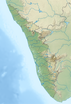
Anathode Dam is a flanking dam of masonry gravity type situated in Sethathode panchayath of Seethathode village in Pathanamthitta district of Kerala, India. This dam is constructed on Anathode river which is a tributary of Pamba river.[1]
| Anathode Dam | |
|---|---|
 | |
| Official name | Anathode Flanking Dam |
| Country | India |
| Location | Pathanamthitta, Kerala |
| Coordinates | 9°20′30″N 77°09′00″E / 9.34167°N 77.15000°E |
| Purpose | Power |
| Status | Operational |
| Construction began | 1964 |
| Opening date | 1967 |
| Owner(s) | Kerala State Electricity Board |
| Dam and spillways | |
| Type of dam | Gravity dam |
| Impounds | Kakki river |
| Height (foundation) | 51.81 m (170.0 ft) |
| Length | 376.12 m (1,234.0 ft) |
| Elevation at crest | 975.36 m (3,200.0 ft) |
| Spillways | 4 |
| Spillway type | Ogee shaped, radial gates, each of size 12.8 x 6.1m |
| Spillway capacity | 1785 m³/sec |
| Reservoir | |
| Creates | Kakki reservoir |
| Total capacity | 455,400,000 m3 (1.608×10¹⁰ cu ft) |
| Active capacity | 446,800,000 m3 (1.578×10¹⁰ cu ft) |
| Catchment area | 225.51 km2 (87.07 sq mi) |
| Normal elevation | 981.46 m (3,220.0 ft) |
| Sabarigiri Power Station | |
| Operator(s) | Kerala State Electricity Board |
| Commission date | 1967 |
| Turbines | 2 x 60 MW & 4 x 55 MW, Pelton-type |
| Installed capacity | 340 MW |
| Annual generation | 1338 MU |
| Website KSEB - Official website | |
Anathode is a stream which joins Kakki river downstream of Kakki dam before the confluence with Pamba river. The dam makes a common reservoir with Kakki. The spillway for the reservoir complex is located by the side of Anathode Flanking Dam. The reservoirs formed by the two dams are connected through the natural valley.[2] Kakki & Anathode dams are about 4 kilometers apart by road. Taluks through which release flows are Ranni, Konni, Kozhencherry, Thiruvalla, Chengannur, Kuttanadu, Mavelikara and Karthikappally.[3]
Specifications
edit- Latitude : 9⁰20’30”N
- Longitude : 77⁰09’00”
- Panchayath : Seethathodu
- Type of Dam : Masonry – Gravity
- Village : Seethathodu
- District : Pathanamthitta
- River Basin : Pamba
- River:Kakki- Anathodu (a tributary of Pamba river)
- Release from Dam to river : Pamba
- Year of completion:1967
- Classification : HH (High Height)
- Maximum Water Level (MWL) : EL 982.16 m
- Full Reservoir Level ( FRL) : EL 981.46 m
- Storage at FRL : 454.14 Mm3
- Height from deepest foundation : 51.81 m[4]
- Length : 376.12 m
- Spillway : 4 No. radial gates, each of size 12.8 x 6.1m
- Crest Level : EL 975.36 m
References
edit- ^ Kerala State, Electricity Board Ltd. "Emergency Action Plan (Tier- I) Pamba, Anathode & Kakki Dams".
- ^ Pathanamthitta. "DM PLANS". Archived from the original on 2021-07-26.
- ^ "Kakki Dam – KSEB Limited Dam Safety Organisation". Retrieved 2021-07-26.
- ^ Indiawris. "Dams in Kerala". Archived from the original on 2021-07-09.

