This article needs additional citations for verification. (December 2018) |
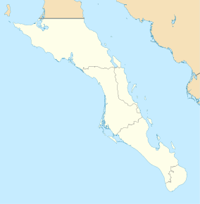
The arch of Cabo San Lucas is a distinctive granitic rock formation at the southern tip of Cabo San Lucas, which is itself the extreme southern end of Mexico's Baja California Peninsula.[1] The arch is locally known as "El Arco," which means "the arch" in Spanish, or "Land's End."[2] It is here that the Pacific Ocean becomes the Gulf of California.
| Arch of Cabo San Lucas | |
|---|---|
 | |
| Location | Cabo San Lucas, Mexico |
| Nearest city | Cabo San Lucas |
| Coordinates | 22°52′34″N 109°53′41″W / 22.8760°N 109.8947°W |
| Elevation | 200 ft (61 m) |
This area is widely used in hotel advertising in the Los Cabos Corridor. This spot is a popular gathering area for sea lions and is frequented by tourists.[3] The Arch of Cabo San Lucas is adjacent to Lovers Beach on the Sea of Cortez side and Divorce Beach on the rougher Pacific Ocean side.[2]
Access
editThe Arch is accessible by land or boat from the beach of the last hotel on the Pacific. Access to the arch requires climbing large rocks.[2][3][4]
Geology
editBasement rock in Los Cabos formed through intrusive igneous processes c. 115 million years ago, during the Cretaceous period.[5] The arch is three stories tall and was formed from natural erosion. Entering the arch in a small watercraft can be somewhat dangerous when the sea is running. The water level can significantly go up and down. Being close to the sides of the arch is not recommended.
References
edit- ^ "Head to La Paz rather than overdeveloped Los Cabos for the real Baja California". The Washington Post. Archived from the original on 2019-10-04.
- ^ a b c "The Arch of Cabo San Lucas". Atlas Obscura. Retrieved 2020-01-08.
- ^ a b "El Arco de Cabo San Lucas - 2020 All You Need to Know BEFORE You Go (with Photos)". TripAdvisor. Retrieved 2020-01-08.
- ^ "El Arco". Travel + Leisure. Archived from the original on 2017-04-12. Retrieved 2020-01-08.
- ^ Fletcher, John; Kohn, Barry; Foster, David; Gleadow, Andrew (2000). "Heterogeneous Neogene cooling and exhumation of the Los Cabos block, southern Baja California: Evidence from fission-track thermochronology". Geology. 28 (2): 107–110. Bibcode:2000Geo....28..107F. doi:10.1130/0091-7613(2000)28<107:HNCAEO>2.0.CO;2.
