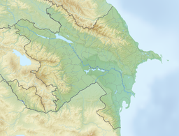
Batabat (Azerbaijani: Batabat) is a tarn in the South Caucasus.
| Batabat | |
|---|---|
 Batabat Lake in 2024 | |
| Location | South Caucasus, Azerbaijan |
| Coordinates | 39°32′20″N 45°47′02″E / 39.539°N 45.784°E |
| Type | tarn |
| Max. length | 0.6 km (0.37 mi) |
| Max. width | 0.6 km (0.37 mi) |
| Surface area | 0.16 km2 (0.062 sq mi) |
| Surface elevation | 2,500 m (8,200 ft) |
It is located in Azerbaijan, in the mountains of Shahbuz District, Nakhichivan Autonomous Republic. Located at an elevation of 2,500 meters above sea level. There is a lake with a 16 ha area is remarkable with a peaty island floating on the surface of the water. There are also natural springs that mineralized with carbonate, hydrocarbonate, and potassium-sodium-magnesium around the lake, which treats Gastrointestinal diseases.
External links
editWikimedia Commons has media related to Batabat Lake.
