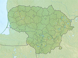
The Baublys (or Antežeriai Lake) is a lake in Krakės Eldership, Kėdainiai District Municipality, central Lithuania. This is the largest lake of Kėdainiai District Municipality. It is located 7 kilometres (4.3 mi) to the west from Krakės town and 1 kilometre (0.62 mi) from Pašušvys village. It belongs to the Šušvė basin (part of the Nevėžis basin).
| Baublys | |
|---|---|
 Baublys Lake from the southern coast | |
| Location | Kėdainiai District Municipality, Lithuania |
| Coordinates | 55°24′26″N 23°36′56″E / 55.40722°N 23.61556°E |
| Etymology | 'bittern' |
| Part of | Šušvė→ Nevėžis→ Neman→ Baltic Sea |
| Primary inflows | Raguva |
| Primary outflows | Raguva |
| Max. length | 0.71 km (0.44 mi) |
| Max. width | 0.18 km (0.11 mi) |
| Surface area | 0.066 km2 (0.025 sq mi)[1] |
| Shore length1 | 1.6 km (0.99 mi) |
| Surface elevation | 89.8 m (295 ft) |
| Settlements | Antežeriai |
| 1 Shore length is not a well-defined measure. | |
On the northern coast Antežeriai village is located. The Baublys Lake and its close surroundings (reed beds) are declared an ornithological sanctuary. It covers an area of 15 hectares (37 acres).[2] The nesting places of Eurasian bittern, spotted crake and other water birds are protected here.
The name Baublys comes from the same Lithuanian word which means 'bittern'.[3]
References
editWikimedia Commons has media related to Baublys Lake.
- ^ "Baublys (ežeras)". Gamtos katalogas. Retrieved 2020-12-14.
- ^ "Draustiniai". keduredija.lt. Kėdainių miškų urėdija. Archived from the original on 2008-03-19.
- ^ Vanagas, Aleksandras (1981). Lietuvių hidronimų etimologinis žodynas (in Lithuanian). Vilnius: Mokslas.

