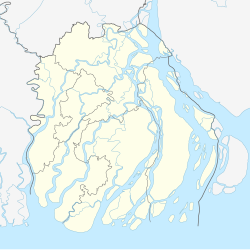
Bhola (Bengali: ভোলা) is a town and district headquarter of Bhola District in the division of Barishal, Bangladesh.
Bhola
ভোলা | |
|---|---|
Town and Municipality | |
| Coordinates: 22°41′11″N 90°38′46″E / 22.686286°N 90.646065°E | |
| Country | |
| Division | Barisal |
| District | Bhola |
| Upazila | Bhola Sadar |
| Government | |
| • Type | Municipality |
| • Paura Mayor | Mohammod Monirujjaman [1] |
| Area | |
| • Total | 31.9 km2 (12.3 sq mi) |
| Population (2011)[2] | |
| • Total | 47,477 |
| • Density | 1,500/km2 (3,900/sq mi) |
| Time zone | UTC+6 (BST) |
Administration Bhola sub-division was established under the Noakhali district in 1845. At that time its administrative center was at Amania of Daulatkhan. The sub-division was included in the Barisal district in 1869. The sub-division then consisted of Daulatkhan and Burhanuddin Hat Thanas and three outposts, namely, Taltali, Gazipur, and Tazumuddin. The sub-divisional headquarters was shifted from Daulatkhan to Bhola in 1876. It was elevated to a district on 1 February 1984.[3]
Demographics
editBhola has 9,635 households and a population of 47,477. 9,320 (19.63%) were under 10 years of age. Bhola had a literacy rate of 76.04% and a sex ratio of 939 females per 1000 males.[2]
Climate
edit| Climate data for Bhola (1991–2020) | |||||||||||||
|---|---|---|---|---|---|---|---|---|---|---|---|---|---|
| Month | Jan | Feb | Mar | Apr | May | Jun | Jul | Aug | Sep | Oct | Nov | Dec | Year |
| Record high °C (°F) | 31.0 (87.8) |
34.7 (94.5) |
38.8 (101.8) |
38.9 (102.0) |
37.8 (100.0) |
37.0 (98.6) |
37.2 (99.0) |
36.6 (97.9) |
37.3 (99.1) |
36.5 (97.7) |
34.5 (94.1) |
31.0 (87.8) |
38.9 (102.0) |
| Mean daily maximum °C (°F) | 25.4 (77.7) |
28.6 (83.5) |
32.0 (89.6) |
33.2 (91.8) |
33.1 (91.6) |
32.0 (89.6) |
31.1 (88.0) |
31.4 (88.5) |
31.6 (88.9) |
31.8 (89.2) |
29.9 (85.8) |
26.7 (80.1) |
30.6 (87.1) |
| Daily mean °C (°F) | 17.8 (64.0) |
21.5 (70.7) |
25.8 (78.4) |
28.2 (82.8) |
28.9 (84.0) |
28.7 (83.7) |
28.2 (82.8) |
28.4 (83.1) |
28.2 (82.8) |
27.3 (81.1) |
23.7 (74.7) |
19.4 (66.9) |
25.5 (77.9) |
| Mean daily minimum °C (°F) | 12.3 (54.1) |
15.8 (60.4) |
20.9 (69.6) |
24.1 (75.4) |
25.3 (77.5) |
26.1 (79.0) |
26.0 (78.8) |
26.1 (79.0) |
25.8 (78.4) |
24.1 (75.4) |
19.3 (66.7) |
14.4 (57.9) |
21.7 (71.1) |
| Record low °C (°F) | 7.2 (45.0) |
9.5 (49.1) |
12.3 (54.1) |
17.5 (63.5) |
19.0 (66.2) |
20.4 (68.7) |
22.7 (72.9) |
23.4 (74.1) |
22.0 (71.6) |
18.5 (65.3) |
13.0 (55.4) |
7.5 (45.5) |
7.2 (45.0) |
| Average precipitation mm (inches) | 8.0 (0.31) |
21.0 (0.83) |
44.0 (1.73) |
98.0 (3.86) |
235.0 (9.25) |
418.0 (16.46) |
448.0 (17.64) |
360.0 (14.17) |
295.0 (11.61) |
192.0 (7.56) |
41.0 (1.61) |
7.0 (0.28) |
2,167 (85.31) |
| Average precipitation days (≥ 1.0 mm) | 1.0 | 2.0 | 3.0 | 6.0 | 12.0 | 19.0 | 24.0 | 23.0 | 17.0 | 9.0 | 2.0 | 1.0 | 119.0 |
| Mean monthly sunshine hours | 190.0 | 198.4 | 212.9 | 208.5 | 184.7 | 128.9 | 117.7 | 133.1 | 136.6 | 190.3 | 209.4 | 180.6 | 2,091.1 |
| Source: NOAA[4] | |||||||||||||
References
edit- ^ "Mayor of Bhola town's Civic body". News24.com. Archived from the original on 2019-09-24. Retrieved 2019-09-13.
- ^ a b "Bangladesh Population and Housing Census 2011 Community Report – Bhola" (PDF). bbs.gov.bd. Bangladesh Bureau of Statistics.
- ^ [1]. Cultural survey report of Bhola District 2007
- ^ "World Meteorological Organization Climate Normals for 1991-2020 — Bhola". National Oceanic and Atmospheric Administration. Retrieved June 13, 2024.

