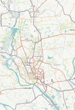
Bimanbandar Thana is a thana of Dhaka City.
Bimanbandar Thana
বিমান বন্দর থানা | |
|---|---|
 Expandable map of vicinity of Bimanbandar Thana | |
| Coordinates: 23°51′03″N 90°24′39″E / 23.8509°N 90.4109°E | |
| Country | |
| Division | Dhaka Division |
| District | Dhaka District |
| Area | |
• Total | 8.02 km2 (3.10 sq mi) |
| Elevation | 23 m (75 ft) |
| Population | |
• Total | 7,424 |
| • Density | 1,325/km2 (3,430/sq mi) |
| Time zone | UTC+6 (BST) |
| Postal code | 1229 |
| Area code | 02[3] |
History
editBimanbandar thana was created in 2001. It is composed of parts of Ward no 1, Ward no 98, and Dakkhinkhan.[4]
Geography
editIt is bounded by pallabi, uttara and Dhakshinkhan Thana on the north, Khilkhet and cantonment thanas on the south, Khilkhet and Dakshinkhan thanas on the east, Cantonment and Pallabi thanas on the west.
Demographics
editAccording to the 2011 Census of Bangladesh, Bimanbandar Thana had 2,120 households with average household size of 4.10 and a population of 10,626. Males constituted 58.41% (6,207) of the population while females 41.59% (4,419). Bimanbandar Thana had a literacy rate (age 7 and over) of 82.7%, compared to the national average of 51.8%, and a sex ratio of 140.There were 39 floating people in this jurisdiction. [6]
The religious breakdown was Muslim 94.74% (10,067), Hindu 4.59% (488), Christian 0.28% (30), Buddhist 0.24% (25), and others 0.15% (16). 35 ethnic people were living there.
References
edit- ^ "Geographic coordinates of Dhaka, Bangladesh". DATEANDTIME.INFO. Retrieved 7 July 2016.
- ^ National Report (PDF). Population and Housing Census 2022. Vol. 1. Dhaka: Bangladesh Bureau of Statistics. November 2023. p. 386. ISBN 978-9844752016.
- ^ "Bangladesh Area Code". China: Chahaoba.com. 18 October 2024.
- ^ "Bimanbandar Thana (Dhaka Metropolitan) - Banglapedia". en.banglapedia.org. Retrieved 12 February 2019.
- ^ "Bangladesh Population and Housing Census 2011 Zila Report – Dhaka" (PDF). bbs.gov.bd. Bangladesh Bureau of Statistics.
- ^ "Community Tables: Dhaka district" (PDF). bbs.gov.bd. 2011.


