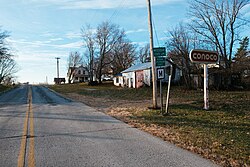
Blanchard is a census-designated place and unincorporated community in Atchison County, Missouri, United States. As of the 2020 census, its population was 27.[3] The community is located on the Iowa border and is adjacent to the city of Blanchard, Iowa.[4] It has sometimes been known as "South Blanchard".[5]
Blanchard, Missouri | |
|---|---|
 | |
| Coordinates: 40°34′30″N 95°12′40″W / 40.57500°N 95.21111°W | |
| Country | |
| State | |
| County | Atchison |
| Area | |
• Total | 0.53 sq mi (1.37 km2) |
| • Land | 0.53 sq mi (1.37 km2) |
| • Water | 0.00 sq mi (0.00 km2) |
| Elevation | 1,034 ft (315 m) |
| Population (2020) | |
• Total | 27 |
| • Density | 50.94/sq mi (19.69/km2) |
| Time zone | UTC-6 (Central (CST)) |
| • Summer (DST) | UTC-5 (CDT) |
| Area code | 660 |
| GNIS feature ID | 2587055[2] |
Demographics
edit| Census | Pop. | Note | %± |
|---|---|---|---|
| 2020 | 27 | — | |
| U.S. Decennial Census[6] | |||
References
edit- ^ "ArcGIS REST Services Directory". United States Census Bureau. Retrieved August 28, 2022.
- ^ a b "Blanchard Census Designated Place". Geographic Names Information System. United States Geological Survey, United States Department of the Interior.
- ^ "Explore Census Data". data.census.gov. Retrieved December 16, 2021.
- ^ "South Blanchard (historical)". Geographic Names Information System. United States Geological Survey, United States Department of the Interior.
- ^ "Atchison County Place Names, 1928-1945 (archived)". The State Historical Society of Missouri. Archived from the original on June 24, 2016. Retrieved August 30, 2016.
{{cite web}}: CS1 maint: bot: original URL status unknown (link) - ^ "Census of Population and Housing". Census.gov. Retrieved June 4, 2016.
