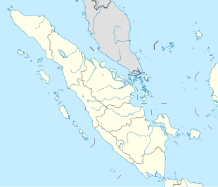
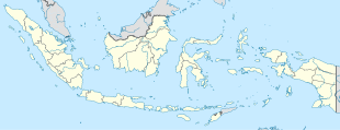
Bungin Tambun I is a village in district Padang Guci Hulu, in Kaur Regency in Bengkulu province and is one of the three villages in the district with the name "Bungin Tambun". Its population is 1068.[1]: 552
Bungin Tambun I | |
|---|---|
| Coordinates: 4°17′9.1716″S 103°17′21.8472″E / 4.285881000°S 103.289402000°E | |
| Country | |
| Province | Bengkulu |
| Regency | Kaur Regency |
| District | Padang Guci Hulu District |
| Elevation | 8,117 ft (2,474 m) |
| Population (2010) | |
• Total | 1,068[1] |
| Time zone | UTC+7 (Indonesia Western Standard Time) |
Climate
editBungin Tambun I has a cold subtropical highland climate (Cfb) with heavy rainfall year-round.
| Climate data for Bungin Tambun I | |||||||||||||
|---|---|---|---|---|---|---|---|---|---|---|---|---|---|
| Month | Jan | Feb | Mar | Apr | May | Jun | Jul | Aug | Sep | Oct | Nov | Dec | Year |
| Mean daily maximum °C (°F) | 17.9 (64.2) |
18.4 (65.1) |
18.7 (65.7) |
18.8 (65.8) |
18.7 (65.7) |
18.2 (64.8) |
17.8 (64.0) |
18.0 (64.4) |
18.3 (64.9) |
18.2 (64.8) |
18.0 (64.4) |
17.7 (63.9) |
18.2 (64.8) |
| Daily mean °C (°F) | 12.7 (54.9) |
13.0 (55.4) |
13.2 (55.8) |
13.5 (56.3) |
13.6 (56.5) |
13.1 (55.6) |
12.6 (54.7) |
12.7 (54.9) |
12.8 (55.0) |
12.9 (55.2) |
13.0 (55.4) |
12.6 (54.7) |
13.0 (55.4) |
| Mean daily minimum °C (°F) | 7.6 (45.7) |
7.6 (45.7) |
7.7 (45.9) |
8.2 (46.8) |
8.5 (47.3) |
8.0 (46.4) |
7.4 (45.3) |
7.4 (45.3) |
7.4 (45.3) |
7.7 (45.9) |
8.0 (46.4) |
7.6 (45.7) |
7.8 (46.0) |
| Average precipitation mm (inches) | 343 (13.5) |
303 (11.9) |
333 (13.1) |
335 (13.2) |
214 (8.4) |
140 (5.5) |
95 (3.7) |
115 (4.5) |
167 (6.6) |
243 (9.6) |
284 (11.2) |
309 (12.2) |
2,881 (113.4) |
| Source: Climate-Data.org[2] | |||||||||||||
See also
editReferences
edit- ^ a b "Archived copy" (PDF). Archived from the original (PDF) on 2013-04-06. Retrieved 2020-07-15.
{{cite web}}: CS1 maint: archived copy as title (link) - ^ "Climate: Bungin Tambun I". Climate-Data.org. Retrieved July 15, 2020.

