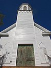
This list includes properties and districts listed on the California Historical Landmark listing in Yuba County, California. Click the "Map of all coordinates" link to the right to view a Google map of all properties and districts with latitude and longitude coordinates in the table below.
Image | [1] | Landmark name | Location | City or town | Summary |
---|---|---|---|---|---|
889 | Bok Kai Temple | First and D Sts 39°08′06″N 121°35′13″W / 39.134994°N 121.586953°W | Marysville | Also on the NRHP list as NPS-75000498 | |
493 | Johnson's Ranch | Tomita Park 39°00′37″N 121°25′23″W / 39.0103°N 121.422917°W | Wheatland | ||
934 | Marysville Assembly Center | Arboga Assembly Center Memorial Site and Interpretive Center 39°02′52″N 121°34′29″W / 39.04777164152989°N 121.5748032957599°W | Marysville | ||
799-3 | Overland Emigrant Trail | Spenceville Rd. 39°02′23″N 121°23′06″W / 39.039633°N 121.385033°W | Wheatland | ||
321 | Smartsville | 8444 Smartville Rd. 39°12′27″N 121°17′55″W / 39.2075°N 121.298611°W | Smartsville, California | California Historic Point of Interest plaque is located at Church of Immaculate Conception.[2] | |
320 | Timbuctoo | Historic district 39°13′01″N 121°19′07″W / 39.216944°N 121.318611°W | Timbuctoo | ||
1003 | Wheatland Hop Riot | S. 'A' St. and 6th St. 39°00′46″N 121°25′08″W / 39.012667°N 121.418833°W | Wheatland |
See also
editWikimedia Commons has media related to California Historical Landmarks in Yuba County, California.
References
edit- ^ "California Historical Landmarks By County". Ohp.parks.ca.gov. Retrieved 2019-04-03.
- ^ "Smartsville (No. 321 California Historical Landmark)". sierranevadageotourism.org. Retrieved August 11, 2019.