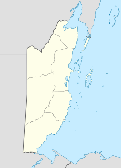
18°0′51.29″N 88°32′32.77″W / 18.0142472°N 88.5424361°W
Carmelita | |
|---|---|
 The football field at the Carmelita sports center. | |
| Coordinates: 18°0′51″N 88°32′33″W / 18.01417°N 88.54250°W | |
| Country | |
| District | Orange Walk District |
| Constituency | Orange Walk East |
| Time zone | UTC-6 (Central) |
| Climate | Am |


Carmelita is a rapidly-expanding village in the Orange Walk District of the nation of Belize. According to the 2010 census, it had a population of 1,474 people.[1] It lies along the New River. Carmelita has the country's only toll booth at the New River bridge on the Northern Highway where the village begins. Beside the bridge lies an access point for boat tours to the Maya historic site, Lamanai.
Carmelita was the inland village featured in the documentary Gringo: The Dangerous Life of John McAfee where John McAfee built multiple properties including a police station (which has since been converted into a house).
References
edit- ^ "Belize Population and Housing Census: 2010 Country Report" (PDF). Statistical Institute of Belize. Archived from the original (PDF) on 27 January 2016. Retrieved 25 July 2015.
