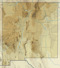
Cathey Peak is a peak in the Sacramento Mountains, in the south-central part of the U.S. State of New Mexico. It lies in Otero County, 10 miles (16 km) southeast of the community of Alamogordo.
| Cathey Peak | |
|---|---|
| Highest point | |
| Elevation | 9,645 ft (2,940 m)[1] |
| Coordinates | 32°48′27″N 105°47′59″W / 32.8075924°N 105.799703°W[2] |
| Geography | |
| Location | Otero County, New Mexico, U.S. |
| Parent range | Sacramento Mountains |
| Topo map | USGS Sacramento Peak |
| Climbing | |
| Easiest route | Road |
Sacramento Peak, at 9,262 feet (2,823 m),[3] is a nearby subpeak of Cathey Peak, and is more widely known due to the presence of several observatories on or near its summit. It is located at 32°47′16″N 105°49′15″W / 32.7878701°N 105.8208140°W,[4] 1.6 miles (2.6 km) southwest of Cathey Peak, and has a topographic prominence of approximately 80 feet (24 m).[5] The Sunspot Solar Observatory is on the summit itself, and the site of this observatory incorporates the small town of Sunspot, less than one-half mile (0.8 km) to the northeast. The Apache Point Observatory is located on a promontory about one-half mile (0.8 km) south of the summit.
Both peaks lie on the high western crest of the Sacramento Mountains, and hence have gentle, forested eastern slopes, and a steep, high escarpment to the west, descending to the Tularosa Basin. Both peaks can be accessed using New Mexico Scenic Byway 6563 from Cloudcroft.
References
edit- ^ "Cathey Peak". ListsOfJohn.com. Retrieved 2014-02-12.
- ^ "Cathey Peak". Geographic Names Information System. United States Geological Survey, United States Department of the Interior. Retrieved 2009-01-22.
- ^ "Sac". NGS Data Sheet. National Geodetic Survey, National Oceanic and Atmospheric Administration, United States Department of Commerce. Retrieved 2009-01-20.
- ^ "Sacramento Peak". Geographic Names Information System. United States Geological Survey, United States Department of the Interior. Retrieved 2009-01-20.
- ^ "Sacramento Peak, New Mexico". Peakbagger.com. Retrieved 2014-02-12.
