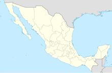
Chilpancingo Airfield (Spanish: Aeropuerto de Chilpancingo); officially Aeródromo Nicolás Bravo (Nicolás Bravo Aerodrome) (ICAO: MMCH, FAA LID: CHG) is a small airfield located in Chilpancingo, Guerrero, México. It handles domestic air traffic and supports flight training and general aviation activities. The airfield is named in honor of the Mexican President Nicolás Bravo. It does not provide scheduled passenger public services. The nearest airport that serves commercial flights is Acapulco International Airport.
Chilpancingo Airfield Aeropuerto de Chilpancingo | |||||||||||
|---|---|---|---|---|---|---|---|---|---|---|---|
 | |||||||||||
| Summary | |||||||||||
| Airport type | Public | ||||||||||
| Serves | Chilpancingo, Guerrero, Mexico | ||||||||||
| Time zone | CST (UTC-06:00) | ||||||||||
| Elevation AMSL | 1,279 m / 4,196 ft | ||||||||||
| Coordinates | 17°34′26″N 99°30′52″W / 17.57389°N 99.51444°W | ||||||||||
| Map | |||||||||||
 | |||||||||||
| Runways | |||||||||||
| |||||||||||
| Statistics (2023) | |||||||||||
| |||||||||||
Source: Agencia Federal de Aviación Civil[1] | |||||||||||
In the early 1960s, the regional airline Aerolíneas del Sur operated a route between Chilpancingo and Puebla with stopovers at the now defunct Tlapa Airfield, Huamuxtitlán, Olinalá, Alcozauca, Tlalixtaquilla, and Malinaltepec.[2]
Situated at an elevation of 1,279 metres (4,196 ft) above mean sea level, it features a single asphalt runway, designated as 15/33, measuring 1,406 by 20 metres (4,613 by 66 ft). Adjacent facilities include small hangars, heliports, and unpaved parking positions for aircraft. The airfield is constrained by its location in a densely populated area of the city.
Gallery
editSee also
editReferences
edit- ^ "Base de Datos de Aeródromos y Helipuertos". Secretaría de Comunicaciones y Transportes. January 2020. Retrieved 9 April 2020.
- ^ "Aviación, Historia de la". Guerrero Cultural Siglo XXI (in Spanish). January 2012. Retrieved 9 June 2017.
External links
edit- Media related to Chilpancingo National Airport at Wikimedia Commons
- Aeronautical chart and airport information for MMCH at SkyVector
- Current weather for MMCH at NOAA/NWS
- Accident history for CHG at Aviation Safety Network
- Chilpancingo Airport information at Great Circle Mapper
- MMCH at Fallingrain.
- MMCH photo at Our Airports.

