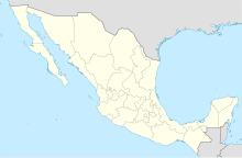
Ciudad del Carmen International Airport (Spanish: Aeropuerto Internacional de Ciudad del Carmen) (IATA: CME, ICAO: MMCE) is an international airport located in Ciudad del Carmen, Campeche, Mexico. It manages both national and international air traffic for the city of Ciudad del Carmen and western Campeche. The airport serves as a gateway for helicopter services within an industrial corridor connecting mainland Mexico to offshore oil fields in the Gulf of Mexico. It also supports cargo flights and various executive and general aviation activities. However, the recent contraction in oil industry activity in the area has had a negative impact on the airport's operations.[2]
Ciudad del Carmen International Airport Aeropuerto Internacional de Ciudad del Carmen | |||||||||||
|---|---|---|---|---|---|---|---|---|---|---|---|
 | |||||||||||
| Summary | |||||||||||
| Airport type | Public | ||||||||||
| Operator | Aeropuertos y Servicios Auxiliares | ||||||||||
| Serves | Ciudad del Carmen, Campeche, Mexico | ||||||||||
| Opened | 1944 | ||||||||||
| Time zone | CST (UTC−06:00) | ||||||||||
| Elevation AMSL | 3 m / 10 ft | ||||||||||
| Coordinates | 18°39′13″N 091°47′56″W / 18.65361°N 91.79889°W | ||||||||||
| Website | www | ||||||||||
| Map | |||||||||||
 | |||||||||||
| Runways | |||||||||||
| |||||||||||
| Statistics (2023) | |||||||||||
| |||||||||||
Source: Agencia Federal de Aviación Civil[1] | |||||||||||
Operated by Aeropuertos y Servicios Auxiliares (ASA), a federal government-owned holding company, the airport handled 339,294 passengers in 2022, increasing slightly to 342,737 in 2023.[1]
History
editBefore the construction of the current airport, Ciudad del Carmen operated Carranza Airport, which provided services for Mexicana de Aviación on the Veracruz-Villahermosa-Ciudad del Carmen-Mérida route since 1928.
The current airport was built in 1942, and it became operational on February 23, 1944, under an agreement with the United States to monitor the area during World War II. The construction cost of the airport was 9 million pesos. Its management became part of Aeropuertos y Servicios Auxiliares (ASA) in 1965.
The oil production boom and infrastructure development associated with the oil industry in the Gulf of Mexico significantly increased operations at the airport. For many decades, the airport offered services to other industrial cities in the Gulf region like Villahermosa, Poza Rica, and Reynosa, major cities like Monterrey, Guadalajara, and Cancun, and international flights to Houston by Continental Express, primarily serving the oil industry market.
Reaching a peak of 661,901 passengers in 2015, the airport has since experienced a decline with the downturn in oil and petrochemical activities in the region.[3] In 2017, United Express canceled service to Houston. Despite a mild rebound in 2019, only 342,737 passengers passed through Ciudad del Carmen in 2023.[1]
Facilities
editThe airport is situated at an elevation of 3 metres (9.8 ft) above sea level, covering an area of 192 hectares (470 acres). It features a single asphalt runway, designated as 05/23, measuring 2,200 metres (7,200 ft) in length. The commercial aviation apron spans 10,484 square metres (112,850 sq ft), featuring three stands for narrow-body aircraft. Official business hours are from 7:00 to 19:00.
The passenger terminal, a single-story structure, caters to both domestic and international arrivals and departures. The departure facilities include check-in areas, a security checkpoint, and a departure concourse with two gates with direct access to the apron. The arrivals section features customs and immigration facilities, a baggage claim zone, and an arrivals hall with car rental services, taxi stands, and several retail stores. Adjacent facilities include parking areas, civil aviation hangars, cargo facilities, and spaces for general aviation.
Within the airport facilities, an independent terminal and a heliport with multiple helipads and hangars serve air connections catered for Pemex, connecting Ciudad del Carmen with offshore oil fields in the Gulf of Mexico. This heliport ranks as the number one in Mexico in terms of flight hours.
Airlines and destinations
editPassenger
edit| Airlines | Destinations |
|---|---|
| Aeroméxico | Mexico City |
| Aeroméxico Connect | Mexico City |
Helicopter services
edit| Airlines | Destinations |
|---|---|
| Apoyo Logístico Aéreo | A subsidiary of Cotemar, is responsible for transporting its personnel and cargo to its own offshore platforms or those in the Strait of Campeche. |
| Asesa | Provides air transportation services for personnel and cargo, as well as maintenance, guardianship, and custody services. |
| Heliservicios Campeche | Local air transportation company involved in transporting personnel and local cargo |
| Helivan | Provides air transportation services in both helicopters and airplanes to CEOs and senior executives of public and private companies. |
| Transportes Aéreos Pegaso | Specialists in executive flights and transportation of personnel to rigs in the Gulf of Mexico. |
Destinations map
editRed = Year-round destination
Blue = Future destination
Green = Seasonal destination
Statistics
editPassengers
editGraphs are unavailable due to technical issues. There is more info on Phabricator and on MediaWiki.org. |
Busiest routes
edit| Rank | City | Passengers | Ranking | Airline |
|---|---|---|---|---|
| 1 | Mexico City, Mexico City | 91,247 | Aeroméxico Connect | |
| 2 | Tamaulipas, Tampico | 3,817 | TAR | |
| 3 | Veracruz, Veracruz | 1,525 | TAR | |
| 4 | Tabasco, Villahermosa | 6 | Aerus |
See also
editReferences
edit- ^ a b c "Estadística Operacional de Aeropuertos / Statistics by Airport". Agencia Federal de Aviación Civil. Retrieved 26 January 2024.
- ^ "Air traffic decreases in Ciudad del Carmen" (in Spanish). February 2017. Retrieved 28 March 2019.
- ^ "Volaris drops flights to Ciudad del Carmen, Campeche".
- ^ "Estadística operacional por origen-destino / Traffic Statistics by City Pairs" (in Spanish). Agencia Federal de Aviación Civil. January 2024. Retrieved 1 February 2024.
External links
edit- Media related to Ciudad del Carmen International Airport at Wikimedia Commons
- Official Website
- Aeropuertos y Servicios Auxiliares
- Ciudad del Carmen Airport information at Great Circle Mapper
- Aeronautical chart and airport information for MMCE at SkyVector
- Current weather for MMCE at NOAA/NWS
- Accident history for CME at Aviation Safety Network

