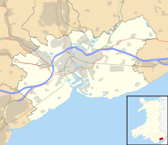
Coed-y-Caerau (Welsh for 'wood of the forts') is a hamlet about 1,400 metres (4,600 ft) north of Langstone in Newport, Wales (Welsh: Casnewydd), historically in Monmouthshire (Welsh: Sir Fynwy). It is the site of prehistoric and Roman hillforts.
| Coed-y-Caerau | |
|---|---|
| Hamlet | |
 Looking southwest across Iron Age and Roman military embankments (Pen-toppen Ash) from Coed-y-Caerau Woods. The parallel shadows delineate part of the northeastern rectangular earthwork. | |
Location within Newport | |
| Community | |
| Principal area | |
| Country | Wales |
| Sovereign state | United Kingdom |
| Police | Gwent |
| Fire | South Wales |
| Ambulance | Welsh |
| UK Parliament | |


History
editIron Age constructions are believed to have been re-used by the Roman military, specifically three connected and unexcavated earthworks just to the north-west of Coed-y-Caeru lane, often referred to in archaeological literature as Pen-toppen Ash (51.6198 north, -2.8998 east). The remains are a south-western oval enclosure about 90m across, a more circular central enclosure of a bank inside a concentric embankment linked to the south-western enclosure with entrances on the south-east and in the north-east, and a roughly rectangular north-eastern enclosure with rounded corners, 108m south-east to nort-west and 96m on the other axis. The latter was previously considered to be a fortlet or watchtower because of its shape but now is thought to be from the Iron Age because of similar late prehistoric enclosures elsewhere in the UK. Around it is a further concentric feature about 166m square[1][2].[3][4]
Immediately north of the earthworks is the remains of a Roman fortlet known as Kemys Craig Roman Fort, running 104m north-west to south-east by 99m, just over 1 hectare. A rampart, 6m wide and 1.2m high, is extant in places as are the remains of entrances in the north-west and south-west sides. It's considered likely the fortlet was contemporaneous with the Roman legion encampment at Usk. Strategically, Caerleon - site of the old Roman fortress of Isca Augusta and of an Iron Age hillfort[5] - and the mouth of the River Usk can be seen from this point.[6]
Physical geography
editThe underlying rocks of Coed-y-Caerau are part of the Brownstone Formation of Old Red Sandstone which forms the crest of a ridge, Kemys Craig, running from south-west to north-east overlooking the River Usk to the north-west. After leaving the Old Roman Road, Coed-y-Caeru Lane follows the line of the ridge north-east for about 2700m towards Wentwood (Welsh: Coed Gwent). Some sources label Pen-toppen Ash (191m above sea-level) as a 'peak'[7] however Ordnance Survey and other maps clearly show the local high point in Coed-y-Caerau Woods at over 210m with higher elevations to the northeast[1].[2][8]
Human geography and local government
editCoed-y-Caerau is in the Newport ward of Bishton and Langstone, lying at the north of the 'Langstone 3' area which had a population of 1356 in 2013. The area is largely rural, reflected in a high percentage of detached, unshared dwellings; its ranking is low for access to services and amenities. Coed-y-Caerau has a very large natural Open Space Provision compared to elsewhere in the ward. Local people are more likely to have higher-level qualifications than in Newport or Wales and unemployment is low, around 1%. It has very low social deprivation. Approximately 30% of households have dependent children and school students perform well above the average for Wales. About 14% of people speak some Welsh, significantly lower than the national average. The crime rate is the lowest in Newport.[9]
The member of parliament for Coed-y-Caerau is Jessica Morden of the Labour Party, representing the Newport East constituency.[10]
References
edit- ^ a b Davies, Geoffrey (2015). Monmouthshire Villages. Ammanford: Sigma Leisure. p. 43. ISBN 9781910758151.
- ^ a b "Coed-y-Caerau Fortlet and Iron Age Hillfort". Roman Britain. Retrieved 20 October 2024.
- ^ "Coed-y-Caerau, Enclosures; Pen Toppen Ash Roman Fortwebsite=Coflein". Retrieved 20 October 2024.
- ^ "Romano-British Southeast Wales Lowland Settlement Survey". The Glamorgan-Gwent Archaeological Trust. Retrieved 13 November 2024.
- ^ "The Roman fortress of Caerleon and its environs: A framework for research". Glamorgan-Gwent Archaeological Trust Ltd. Retrieved 21 October 2024.
- ^ "Kemys Craig Roman Fort". Roman Britain. Retrieved 20 October 2024.
- ^ "Node: Pen-toppen-ash". Open Street Map. Retrieved 13 November 2024.
- ^ "Monmouthshire XXIX". National Library of Scotland. Retrieved 13 November 2024.
- ^ "Newport Ward Profile Langstone" (PDF). Cyngor Dinas Casnewydd. Retrieved 13 November 2024.
- ^ "Jessica Morden". UK Parliament. Retrieved 13 November 2024.
