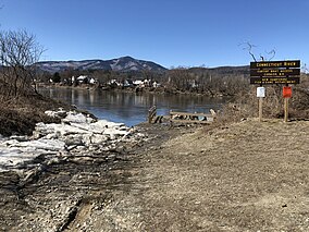
The Cornish Wildlife Management Area is one of 124 New Hampshire State Wildlife Management Areas (WMAs). It is located in Cornish and covers 29 acres (120,000 m2; 12 ha).
| Cornish Wildlife Management Area | |
|---|---|
 Connecticut River boat access after ice-out, 2019. Mount Ascutney in Vermont in the background. | |
 | |
| Nearest town | Cornish, New Hampshire |
| Coordinates | 43°28′43.25″N 72°22′40.33″W / 43.4786806°N 72.3778694°W |
| Governing body | New Hampshire Fish & Game Department |
| Website | wildlife |
History
editThe Cornish WMA was purchased in 1972 with Federal Aid in Sport Fish Restoration Act funds to, in this case, provide anglers access to the Connecticut River. A boat ramp was subsequently built on the property in 1974.[1] As of May 2013, there were eight agricultural preservation restrictions or conservation easements along New Hampshire Route 12A in Cornish, all of which have been set up by private landowners to protect the farmland for future generations. The Cornish Wildlife Management Area and Saint-Gaudens National Historic Site in Cornish also protect land along Route 12A.[2]
| ||||||||||||||||||||||||||||||||||||||||||||||||||||||||||||||||||||||||||||||||||||||||||||||||||||||||||||||||
WMAs
editWMAs, in general, are designated for protection and improvement of habitat wildlife, and for public recreation, including hunting, fishing, trapping (by permit only), and wildlife watching. WMAs are subsidized by the Federal government under the authority of the Dingell–Johnson Act (aka the Federal Aid in Sport Fish Restoration Act), enacted in 1950, authorizing the Secretary of the Interior to provide financial assistance for state fish restoration and management plans and projects.[3]
See also
editOther nearby Wildlife Management Areas
edit- Little Ascutney Wildlife Management Area, Weathersfield and West Windsor – 860 acres and included Little Ascutney Mountain and Pierson's Peak
- Hawks Mountain Wildlife Management Area, Cavendish and Baltimore – 2,183 acres in the southern Green Mountains
- Knapp Brook Wildlife Management Area, Cavendish and Reading – 1,530 acres
- Arthur Davis Wildlife Management Area, Reading, Vermont, 7,788 acres
- Skitchewaug Wildlife Management Area, Springfield – 216 acres
- Densmore Hill Wildlife Management Area, Hartland – 252 acres
- Plymsbury Wildlife Management Area, Plymouth – 1,859 acres
- Spaulding Wildlife Management Area, Charlestown, New Hampshire – 54 acres, next to the Hubbard Hill State Forest
- Chase Island Wildlife Management Area, Cornish, New Hampshire – 10 acres on the Connecticut River
Nearby state lands
editNational Wildlife Refuges in New Hampshire and Vermont
editReferences
edit- ^ Cornish Wildlife Management Area, geographical data via GeoNames
- ^ Natural Resources Inventory, Cornish, New Hampshire, Cornish Conservation Commission (2013)
- ^ "Federal Aid in Sport Fish Restoration Act". Federal Wildlife Laws Handbook. Center for Wildlife Law, University of New Mexico School of Law. n.d. Archived from the original on 2007-11-18. Retrieved 2008-01-20.