| Submission declined on 10 October 2024 by Dan arndt (talk). This submission is not adequately supported by reliable sources. Reliable sources are required so that information can be verified. If you need help with referencing, please see Referencing for beginners and Citing sources.
Where to get help
How to improve a draft
You can also browse Wikipedia:Featured articles and Wikipedia:Good articles to find examples of Wikipedia's best writing on topics similar to your proposed article. Improving your odds of a speedy review To improve your odds of a faster review, tag your draft with relevant WikiProject tags using the button below. This will let reviewers know a new draft has been submitted in their area of interest. For instance, if you wrote about a female astronomer, you would want to add the Biography, Astronomy, and Women scientists tags. Editor resources
|  |
| Submission declined on 1 October 2024 by Theroadislong (talk). This draft's references do not show that the subject qualifies for a Wikipedia article. In summary, the draft needs multiple published sources that are: Declined by Theroadislong 59 days ago.
|  |
 Comment: Without any inline citations (See WP:REFB) this is entirely original research. Requires additional reliable secondary sources. Dan arndt (talk) 07:00, 10 October 2024 (UTC)
| Griqualand west basin | |
|---|---|
| Highest point | |
| Elevation | 950 m (3,120 ft) |
| Coordinates | 25°09′28″S 26°44′11″E / 25.15778°S 26.73639°E |
| Dimensions | |
| Length | 350 km (220 mi) |
| Width | 15 km (9.3 mi) |
| Geography | |
| Country | South Africa |
| Provinces | Northern cape |
| Geology | |
| Rock age | Archean and proterozoic |
| Rock type(s) | Quartz arenites, shale and dolomite |
| Climbing | |
| Easiest route | From Northwest or Vryburg |
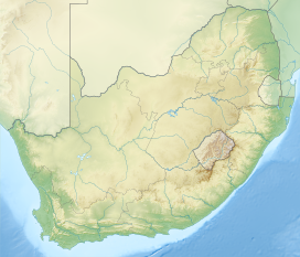
The Griqualand west basin occurs within the Transvaal basin 2.5 million years ago in the Northern Cape province. It was founded by the Khoisan people who are the xhosa natives.The karoo biome occurs within this basin.
Geology
editIn his 1986 study, Beukes posits that the sediments of the Griqualand West Sequence The sediments were deposited in three major tectonic-sedimentary environments, including a shallow water platform. A platform edge and a deeper basin are present in the west and south-west of the continent. Stratigraphically, these environments correspond These are in turn correlated with the Schmidtsdrif Formation, the limestones and cherts. and cherts of the Ghaap Plateau Formation. Jaspilites of the Asbesberg Formation. The lower Schmidtsdrif Formation is composed of fluvially deposited quartz arenites and shallow-marine sediments, as well as a carbonate platform sequence. Carbonate platform sequence. In the basin located to the southwest of the platform. The sediments that overlie the carbonate platform sequence at the edge of the basin southwest of the platform are carbonaceous. Carbonaceous shales. The Ghaap Plateau Formation is characterised by the presence of stromatolitic deposits. The sediments consist of dolomite and limestone plateau deposits. In the direction of the In the basin, this facies is overlain by laminated limestone and dolomite. Dolomite, some of which are carbonate turbidites, is also present. In the basin, the turbidite sediments undergo ankeritisation. These sediments were subsequently ankeritised and partly silicified, resulting in the formation of banded ferruginous chert. Subsequently, these sediments were deposited with the carbonaceous shales within the basin. The limestone sequence of the platform was deposited in the basin. The entire platform sequence is completely dolomitised, with the exception of the edge. In areas where limestone-rich zones are preserved. The cessation of deposition of carbonates in the shallow water was caused by the transgression. The deposition of carbonates in shallow water on the shelf and the formation of microbands of iron are both processes that occurred concurrently.
Formations
editMakganyene Formation Mixed sedimentation at the basal contact of the Makganyene Formation reveals intercalations between diamictite and lesser iron formation, shales, sandstones, and conglomerates in the area between Sishen and Rooinekke (de Villiers and Visser, 1977; Polteau and Moore, 1999; Visser, 1999). The main diamictite is a massive rock with poorly sorted clasts, some facetted and striated. Maximum class size decreases progressively westwards across the Griqualand West basin ( Visser, 1999). The basal intercalations with shale and sandstone include graded beds (diamictite-to-black shale) and occasional dropstones, indicating a transition to marine facies. Where the Koegas Subgroup underlies the Makganyene Formation, it consists of a similar diverse suite of rock types, and the contact between the two units is of an intercalated nature. The iron formations interbedded with the Makganyene diamictites are compositionally and isotopically similar to those of the underlying Koegas and Asbesheuwels Subgroups ( Polteau and Moore, 1999).Hotazel and Mooidraai Formations Iron formations in the Hotazel Formation immediately overlying the Ongeluk lavas, are similar in major, trace, and rare earth element composition and isotopic character to those of the Asbesheuwels and Koegas Subgroups beneath the Makganyene Formation (Tsikos and Moore, 1997; Tsikos, 1999). Taken as a single entity, the Ghaap–Postmasburg succession displays a symmetry: carbonate – iron formation – diamictite/lavas – iron formation – carbonate ( Fig. 3). Carbonate O and C stable isotope profiles reveal a progressive excursion to lighter values from Campbell and carbonates into Asbesheuwels iron formations (Beukes et al., 1990) that persists to the base of the Makganyene diamictite.
Reference
edit- ^ Deconstructing the Transvaal Supergroup, South Africa: implications for Palaeoproterozoic palaeoclimate models John M. Moore, Harilaos Tsikos and Stefane Polteau
