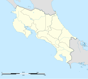
Escazú is a district of the Escazú canton, in the San José province of Costa Rica.[1][2]
Escazú | |
|---|---|
 Skyline of Escazu City | |
 Escazú district | |
| Coordinates: 9°54′58″N 84°08′45″W / 9.9159843°N 84.1458602°W | |
| Country | |
| Province | San José |
| Canton | Escazú |
| Area | |
• Total | 4.56 km2 (1.76 sq mi) |
| Elevation | 1,101 m (3,612 ft) |
| Population (2011) | |
• Total | 11,984 |
| • Density | 2,600/km2 (6,800/sq mi) |
| Time zone | UTC−06:00 |
| Postal code | 10201 |
Geography
editEscazú has an area of 4.56 km2[3] and an elevation of 1,101 metres.[1]
It is located on the northeast slopes of the Cerros de Escazú, 9 kilometers west of the national capital city of San José, and lies in the center of the canton, limiting west to Santa Ana Canton, north to San Rafael district and south to San Antonio district.[4]
Demographics
edit| Census | Pop. | ±% p.a. |
|---|---|---|
| 1864 | 2,533 | — |
| 1883 | 170 | −13.25% |
| 1892 | 961 | +21.22% |
| 1927 | 2,143 | +2.32% |
| 1950 | 3,031 | +1.52% |
| 1963 | 6,182 | +5.64% |
| 1973 | 9,858 | +4.78% |
| 1984 | 10,505 | +0.58% |
| 2000 | 12,379 | +1.03% |
| 2011 | 11,984 | −0.29% |
| 2022 | 12,590 | +0.45% |
| Source: Instituto Nacional de Estadística y Censos[5] Centro Centroamericano de Población[6] | ||
For the 2011 census, Escazú had a population of 11,984 inhabitants.[7]
The area is inhabited primarily by upper-mid to high income families, and known in the Costa Rican collective consciousness as home to the country's economic elite. Escazu is the wealthiest and most prominent city in the country catering to wealthy Americans and Europeans as well as wealthy locals. [citation needed]
Escazú has a relatively large Jewish population, and several synagogues.[8]
Climate
editThe climate is mostly tropical: it is not unknown for Escazú to experience rainfall on a day in which San José is dry and sunny. November and December frequently bring high winds.
Economy
editEscazú is one of the most affluent places in Costa Rica, with many expensive restaurants and shops, and has some of the most exclusive shopping and dining venues in the country. It has commercial developments, like Avenida Escazú, which holds the country's first IMAX theater. Avenida Escazú is a modern outdoor mall/center. This mall has many international brands and a campus of Texas Tech University. Another unique feature of Escazu is that it is home to one of the most luxurious malls in Costa Rica, Multiplaza Escazu, with stores from large international brand names.
Locations
editMany locations in the city are prized for their scenic outlooks. This zone is one of the most developed parts in the metropolitan area, populated by families with high incomes. Escazú contains many apartment blocks and residential areas.
Over the past couple of decades, Escazú has become an expatriate enclave: several embassies have their residences located here, including the residence of the US Ambassador, Dutch, British, German, Canadian, and South Korean Ambassadors. The past few years have seen a significant influx of newly arrived foreigners from North America, South America and Europe. It is home to many bars and restaurants, especially those of the more chic (and expensive) variety. Rents and prices reflect this and Escazú is one of the most well-known upscale locations in Costa Rica. The city offers many venues that are English speaking oriented like movie theaters, health clinics, business centers and a luxury country club.
Transportation
editRoad transportation
editThe district is covered by the following road routes:
Sports
editThe football soccer club Brujas F.C. was born here. The name of the team "Brujas" is a reference to the nickname of the city "La ciudad de las brujas" (The City of the Witches). However, the team moved in 2009 to Desamparados.
References
edit- ^ a b "Declara oficial para efectos administrativos, la aprobación de la División Territorial Administrativa de la República N°41548-MGP". Sistema Costarricense de Información Jurídica (in Spanish). 19 March 2019. Retrieved 26 September 2020.
- ^ División Territorial Administrativa de la República de Costa Rica (PDF) (in Spanish). Editorial Digital de la Imprenta Nacional. 8 March 2017. ISBN 978-9977-58-477-5.
- ^ "Área en kilómetros cuadrados, según provincia, cantón y distrito administrativo". Instituto Nacional de Estadística y Censos (in Spanish). Archived from the original on 24 October 2020. Retrieved 26 September 2020.
- ^ Mapa Cantonal del Censo de 1984, published by the National Institute of Statistics and Census(INEC) and updated by the Central American Population Center (CCP)
- ^ "Instituto Nacional de Estadística y Censos" (in Spanish).
- ^ Centro Centroamericano de Población de la Universidad de Costa Rica. "Sistema de Consulta a Bases de Datos Estadísticas" (in Spanish).
- ^ "Censo. 2011. Población total por zona y sexo, según provincia, cantón y distrito". Instituto Nacional de Estadística y Censos (in Spanish). Retrieved 26 September 2020.
- ^ "The Jewish Traveler: Costa Rica". Hadassah Magazine. 2006-12-12. Retrieved 2021-02-16.
