Size of this preview: 453 × 600 pixels. Other resolutions: 181 × 240 pixels | 363 × 480 pixels | 580 × 768 pixels | 1,209 × 1,600 pixels.
Original file (1,209 × 1,600 pixels, file size: 430 KB, MIME type: image/jpeg)
Summary
edit
| Description |
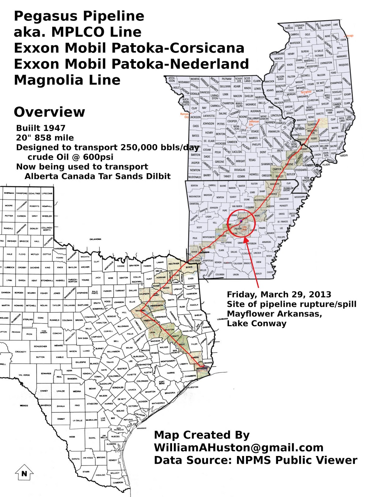
This is the Exxon-Mobil Pegasus pipeline, which ruptured in Mayflower Arkansas in 2003. See: 2013 Mayflower oil spill |
|---|---|
| Source |
I created this using GIMP and the NPMS Public Viewer |
| Date |
2013 |
| Author | |
| Permission (Reusing this file) |
See below.
|
- Other information
Originally published here: http://williamahuston.blogspot.com/2013/04/pegasus-pipeline-maps.html If Text does not meet Wikipedia policy, PLEASE notify me on my talk page and give me a week or so to fix it before deletion. Thanks!
Licensing
edit
I, the copyright holder of this work, hereby publish it under the following licenses:
 | Permission is granted to copy, distribute and/or modify this document under the terms of the GNU Free Documentation License, Version 1.2 or any later version published by the Free Software Foundation; with no Invariant Sections, no Front-Cover Texts, and no Back-Cover Texts. |
| This work is licensed under the Creative Commons Attribution-ShareAlike 3.0 License. |
You may select the license of your choice.
File history
Click on a date/time to view the file as it appeared at that time.
| Date/Time | Thumbnail | Dimensions | User | Comment | |
|---|---|---|---|---|---|
| current | 02:14, 30 March 2016 | | 1,209 × 1,600 (430 KB) | Bhuston (talk | contribs) | Uploading a self-made file using File Upload Wizard |
You cannot overwrite this file.
File usage
The following pages on the English Wikipedia use this file (pages on other projects are not listed):