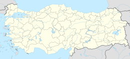
Hekim Island (a.k.a. Kilise Island) is an Aegean island of Turkey. It is in the gulf of İzmir and a part of Urla ilçe (district) of İzmir Province at 38°26′41″N 26°45′56″E / 38.44472°N 26.76556°E.[1] It is the second largest of the islands in the gulf (collectively known as Urla Islands) with 2.5 square kilometres (0.97 sq mi) area.[2] The nearest point on the main land to the west is 2.5 kilometres (1.6 mi) distant. Presently the visits to island are not allowed.[3]
Native name: Hekim Adası | |
|---|---|
| Geography | |
| Location | Aegean Sea |
| Coordinates | 38°26′41″N 26°45′56″E / 38.44472°N 26.76556°E |
| Administration | |
| İl (province) | İzmir Province |
| İlçe | Urla |
| Area covered | 2.5 km2 (0.97 sq mi) |
Scholars tentatively identify Hekim Island with the island anciently known as Pele (Ancient Greek: Πήλη),[4][5] which was opposite to Clazomenae and was noted by numerous ancient authors including Thucydides,[6] Pliny the Elder,[7] and Stephanus of Byzantium.[8] During the Peloponnesian War after an unsuccessful attack in Clazomenae, some of the ships in the Astyochus fleet were put at the Marathusa, Pele and Drimyssa islands which lie over against Clazomenae.[9]
Trivia
editThe name of the island hekim means "doctor". According to a legend a doctor who was on his way to Greece according to the Population exchange between Greece and Turkey agreement chose to stay in İzmir and settled in the island to create his own farm.[3]
References
edit- ^ Map page
- ^ Islam encyclopaedia (in Turkish)
- ^ a b İzmir peninsula news (in Turkish)
- ^ Richard Talbert, ed. (2000). Barrington Atlas of the Greek and Roman World. Princeton University Press. p. 56, and directory notes accompanying. ISBN 978-0-691-03169-9.
- ^ Lund University. Digital Atlas of the Roman Empire.
- ^ Thucydides. History of the Peloponnesian War. Vol. 8.31.
- ^ Pliny. Naturalis Historia. Vol. 5.31.38, 32.2.9.
- ^ Stephanus of Byzantium. Ethnica. Vol. s.v. Πήλη.
- ^ Thucydides, History of the Peloponnesian War, 8.31
