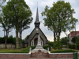
Hendecourt-lès-Ransart (French pronunciation: [ɑ̃dkuʁ lɛ ʁɑ̃saʁ], literally Hendecourt near Ransart) is a commune in the Pas-de-Calais department in the Hauts-de-France region of France.[3]
Hendecourt-lès-Ransart | |
|---|---|
 The church of Hendecourt-lès-Ransart | |
| Coordinates: 50°12′21″N 2°43′59″E / 50.2058°N 2.7331°E | |
| Country | France |
| Region | Hauts-de-France |
| Department | Pas-de-Calais |
| Arrondissement | Arras |
| Canton | Avesnes-le-Comte |
| Intercommunality | CC Campagnes de l'Artois |
| Government | |
| • Mayor (2020–2026) | Pierre Barrois[1] |
Area 1 | 2.21 km2 (0.85 sq mi) |
| Population (2021)[2] | 138 |
| • Density | 62/km2 (160/sq mi) |
| Time zone | UTC+01:00 (CET) |
| • Summer (DST) | UTC+02:00 (CEST) |
| INSEE/Postal code | 62425 /62175 |
| Elevation | 90–124 m (295–407 ft) (avg. 122 m or 400 ft) |
| 1 French Land Register data, which excludes lakes, ponds, glaciers > 1 km2 (0.386 sq mi or 247 acres) and river estuaries. | |
Geography
editA small farming village situated 7 miles (11 km) south of Arras, on the D4 road.
History
editThe etymology of the name begins as ‘’’Hetnanicurtis’’, the small area (curtis) belonging to someone by the name of Hetna, in the Merovingian time. The name has changed over the years: Hendecourdelle (1300); Hendecourdel (1300, 1380, 1450, 1457, 1552, 1556, 1574, 1578); Hendecordel (1338, 1400); Hennecourt (1500); Hendecorde (1565); Hennnecordel (1723); Hendecourt (1804); Hendecourt-Lez-Ransart in the 19th century and finally Hendecourt-Les-Ransart.
The first chateau was probably built around 1703 by Louis-Joseph Le Sergeant of Hendecourt on the site of an earlier manor house. The chateau and its farm were sold in 1878 to the Diesbach de Belleroche family from Fribourg Switzerland, who still own it today.
The entire village and chateau were completely destroyed between 1914-1918 then rebuilt.
The old flour mill was dismantled in 1912.
Population
edit| Year | Pop. | ±% p.a. |
|---|---|---|
| 1968 | 132 | — |
| 1975 | 120 | −1.35% |
| 1982 | 118 | −0.24% |
| 1990 | 123 | +0.52% |
| 1999 | 125 | +0.18% |
| 2007 | 124 | −0.10% |
| 2012 | 122 | −0.32% |
| 2017 | 135 | +2.05% |
| Source: INSEE[4] | ||
Places of interest
edit- The church of Notre-Dame, rebuilt along with the rest of the village, after World War I.
- The chateau.
See also
editReferences
edit- ^ "Répertoire national des élus: les maires". data.gouv.fr, Plateforme ouverte des données publiques françaises (in French). 2 December 2020.
- ^ "Populations légales 2021" (in French). The National Institute of Statistics and Economic Studies. 28 December 2023.
- ^ INSEE commune file
- ^ Population en historique depuis 1968, INSEE


