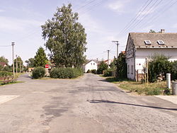
Hlinka (German: Glemkau) is a municipality and village in Bruntál District in the Moravian-Silesian Region of the Czech Republic. It has about 200 inhabitants.
Hlinka | |
|---|---|
 Centre of Hlinka | |
| Coordinates: 50°16′48″N 17°40′20″E / 50.28000°N 17.67222°E | |
| Country | |
| Region | Moravian-Silesian |
| District | Bruntál |
| First mentioned | 1267 |
| Area | |
• Total | 8.74 km2 (3.37 sq mi) |
| Elevation | 254 m (833 ft) |
| Population (2024-01-01)[1] | |
• Total | 202 |
| • Density | 23/km2 (60/sq mi) |
| Time zone | UTC+1 (CET) |
| • Summer (DST) | UTC+2 (CEST) |
| Postal code | 793 99 |
| Website | www |
Etymology
editThe name, which is a diminutive form of hlína (i.e. 'clay'), is derived from the clay quarrying that took place here. It was first called Glynik, the name Hlinka first appeared in 1389.[2]
Geography
editHlinka is located about 35 kilometres (22 mi) northeast of Bruntál and 64 km (40 mi) northwest of Ostrava. It is located in the Osoblažsko microregion on the border of with Poland. The southwestern part of the municipal territory lies in the Zlatohorská Highlands and the northeastern part extends into the Opava Hilly Land. The highest point is at 341 m (1,119 ft) above sea level.
In the northern part is located Velký Pavlovický rybník Nature Reserve with Pavlovický Pond I, which has extraordinary importance as a stop of migratory birds and nesting places of water birds.[3] It has an area of 30.8 ha (76 acres). Amphibian populations are also subject to protection, especially European fire-bellied toad.[4]
History
editThe first written mention of Hlinka is from 1267. It was an agricultural village that was part of the Osoblaha estate owned by the bishops of Olomouc. In the 16th century, it was acquired by Lords of Vrbno, who sold it to the Sedlnický of Choltice family at the end of the 16th century. After the properties of the family were confiscated in 1622 for their participation in the Bohemian Revolt, it was joined to the Dívčí Hrad estate and shared its owners and destinies.[2]
Demographics
edit
|
|
| ||||||||||||||||||||||||||||||||||||||||||||||||||||||
| Source: Censuses[5][6] | ||||||||||||||||||||||||||||||||||||||||||||||||||||||||
Transport
editThere are no railways or major roads passing through the municipality. On the Czech-Polish broder is the Rylovka / Krzyżkowice road border crossing.
Sights
editThe only protected cultural monument is the Church of Saint Valentine. It is a small rural church built in 1813. The bell in the church dates from 1780.[7]
References
edit- ^ "Population of Municipalities – 1 January 2024". Czech Statistical Office. 2024-05-17.
- ^ a b "Historie" (in Czech). Obec Hlinka. Retrieved 2022-05-10.
- ^ "Přírodní rezervace Velký Pavlovický rybník" (in Czech). CzechTourism. Retrieved 2022-05-10.
- ^ "Velký Pavlovický rybník" (in Czech). Nature Conservation Agency of the Czech Republic. Retrieved 2023-10-30.
- ^ "Historický lexikon obcí České republiky 1869–2011" (in Czech). Czech Statistical Office. 2015-12-21.
- ^ "Population Census 2021: Population by sex". Public Database. Czech Statistical Office. 2021-03-27.
- ^ "Kostel" (in Czech). Obec Hlinka. Retrieved 2022-05-10.


