This article has multiple issues. Please help improve it or discuss these issues on the talk page. (Learn how and when to remove these messages)
|
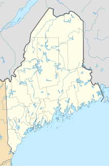
The Howland Research Forest is a 555-acre (225 ha) tract of mature evergreen forest in the North Maine Woods, within Penobscot County, central Maine, US. It is located west of the town of Howland.
| Howland Forest | |
|---|---|
 View of the Howland Forest canopy from one of the site's research towers. | |
| Location | Maine, United States |
| Nearest city | Bangor |
| Coordinates | 45°12′N 68°44′W / 45.200°N 68.733°W[1] |
| Owner | Northeast Wilderness Trust |
History
editThe tract is part of the 1.1 million acres (4,500 km2) of Maine forest sold in 2005 by International Paper (IP) to the Seven Islands Land Company, a private forest investment management holding company. In 2007, the research forest was purchased by Northeast Wilderness Trust ensuring its wild and natural state into the future.[2]
The Howland Forest is a founding member of the AmeriFlux and FLUXNET research networks.[2]
Ecology
editThe Howland Forest study site is located in a boreal transitional forest of the New England/Acadian forests ecoregion. The forest is dominated by mixed spruce, hemlock, aspen, and birch stands ranging in age from 45 to 130 years. The soils are formed on coarse-loamy granitic basal till.[3]
Research forest
editThe tract had previously been designated as a research forest under IP's ownership, attracting researchers from the US Forest Service, the University of Maine, NASA, NOAA, and the Woods Hole Research Center. Areas of study included acid rain, nutrient cycling, soil ecology, and more recently, forest carbon uptake and loss. The forest has one of the longest records of carbon flux measurement in the world, dating to 1996, providing important information about carbon sequestration in mature forests.
References
edit- ^ "Site description". howlandforest.org. Archived from the original on 2007-08-05.
- ^ a b Howland Forest website: http://www.howlandforest.org/
- ^ "Woods Hole Research Center". Archived from the original on 2007-06-09.
External links
edit
