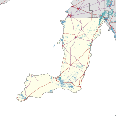
Kainton is a small town in the Australian state of South Australia situated about 10 km south of Paskeville in the upper Yorke Peninsula.
| Kainton South Australia | |||||||||||||||
|---|---|---|---|---|---|---|---|---|---|---|---|---|---|---|---|
| Coordinates | 34°7′S 137°54′E / 34.117°S 137.900°E | ||||||||||||||
| Population | 54 (SAL 2021)[1] | ||||||||||||||
| Postcode(s) | 5552 | ||||||||||||||
| Time zone | ACST (UTC+9:30) | ||||||||||||||
| • Summer (DST) | ACDT (UTC+10:30) | ||||||||||||||
| LGA(s) | Yorke Peninsula Council | ||||||||||||||
| Region | Yorke and Mid North[2] | ||||||||||||||
| County | Daly[3] | ||||||||||||||
| State electorate(s) | Narungga[4] | ||||||||||||||
| Federal division(s) | Grey[5] | ||||||||||||||
| |||||||||||||||
| Footnotes | Adjoining localities[3] | ||||||||||||||
The Kainton school closed in 1907, but the "Hundred of Clinton School" was renamed "Kainton School" in 1915.[6]
Kainton is located within the federal Division of Grey, the state electoral district of Narungga and the local government area known as the Yorke Peninsula Council.[3][5][4]
See also
editNotes and references
edit- Notes
- Citations
- ^ Australian Bureau of Statistics (28 June 2022). "Kainton (suburb and locality)". Australian Census 2021 QuickStats. Retrieved 28 June 2022.
- ^ "Yorke and Mid North SA Government region" (PDF). The Government of South Australia. Retrieved 17 April 2017.
- ^ a b c "Search result(s) for Kainton (LOCB) (Record No. SA0033456) with the following layers being selected - "Suburbs and Localities", "Counties", "Hundreds", "Place names (gazetteer)" and "Road labels"". Property Location Browser. Government of South Australia. Archived from the original on 12 October 2016. Retrieved 28 April 2017.
- ^ a b Narungga (Map). Electoral District Boundaries Commission. 2016. Retrieved 1 March 2018.
- ^ a b "Federal electoral division of Grey" (PDF). Australian Electoral Commission. Retrieved 24 July 2015.
- ^ "Manning index of South Australia". State Library of South Australia. Retrieved 9 October 2015.
