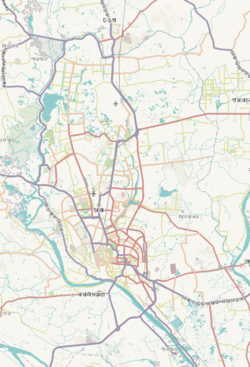
Kalabagan (Bengali: কলাবাগান) is a Thana in Dhaka, Bangladesh,[4] adjacent to Dhanmondi and Jatiya Sangsad.[5]
Kalabagan Thana
কলাবাগান থানা | |
|---|---|
 Expandable map of vicinity of Kalabagan Thana | |
| Coordinates: 23°44′56″N 90°22′55″E / 23.74882°N 90.38182°E | |
| Country | |
| Division | Dhaka Division |
| District | Dhaka District |
| Area | |
• Total | 1.26 km2 (0.49 sq mi) |
| Elevation | 23 m (75 ft) |
| Population | |
• Total | 114,254 |
| • Density | 94,175/km2 (243,910/sq mi) |
| Time zone | UTC+6 (BST) |
| Postal code | 1205 |
| Area code | 02[3] |
Geography
editKalabagan is bounded by Sher-e-Bangla Nagar Thana and Tejgaon Thana on the north, New Market Thana on the south, Ramna Thana on the east and Dhanmondi Thana on the west. The thana has an area of 1.26 km2.[5]
Demographics
editAccording to the 2011 Census of Bangladesh, Kalabagan Thana had 20,672 households with average household size of 4.86 and a population of 118,660. Males constituted 57.11% (67,762) of the population while females 42.89% (50,898). Kalabagan had a literacy rate (age 7 and over) of 82.0%, compared to the national average of 51.8%, and a sex ratio of 133.There were 720 floating people in this jurisdiction. [7]
The religious breakdown was Muslim 94.49% (112,122), Hindu 4. 84% (5,740), Christian 0.47% (554), Buddhist 0.16% (184), and others 0.05% (60). The ethnic minority people living there were 237 persons in total.
Education
editThere are many educational institutions located in Kalabagan Thana like Hamdard Public College and Dhaka Public College.
Establishments
editReferences
edit- ^ "Geographic coordinates of Dhaka, Bangladesh". DATEANDTIME.INFO. Retrieved 7 July 2016.
- ^ National Report (PDF). Population and Housing Census 2022. Vol. 1. Dhaka: Bangladesh Bureau of Statistics. November 2023. p. 386. ISBN 978-9844752016.
- ^ "Bangladesh Area Code". China: Chahaoba.com. 18 October 2024.
- ^ "Owner knifed, car hijacked in Kalabagan". The Daily Star. 2017-02-09. Retrieved 2017-03-21.
- ^ a b "Kalabagan Thana". Banglapedia. Retrieved 2017-03-21.
- ^ Bangladesh Bureau of Statistics (2011). "Population & Housing Census" (PDF). Bangladesh Government. Archived from the original (PDF) on 3 September 2017. Retrieved 17 April 2015.
- ^ "Community Tables: Dhaka district" (PDF). bbs.gov.bd. 2011.
- ^ "Kalabagan keep hopes alive after 29-run win in truncated match". Cricinfo. Retrieved 2017-03-21.


