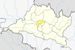
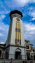
Kathmandu District (Nepali: काठमाडौं जिल्ला; Nepal Bhasa: ये: जिल्ला) is a district located in Kathmandu Valley, Bagmati Province of Nepal. It is one of the 77 districts of Nepal, covers an area of 413.69 km2 (159.73 sq mi), and is the most densely populated district of Nepal with 1,081,845 inhabitants in 2001, 1,744,240 in 2011 and 2,017,532 in 2021.[1][2] The administrative headquarters of Kathmandu district is located in Kathmandu. The city has 21 post offices which handle mail from across the country and beyond, with Kathmandu DPO having 44,600 as its postal code for international mail delivery services like UPS or DHL Couriers etc.
Kathmandu District
काठमाडौं जिल्ला | |
|---|---|
Kathmandu's skyline with Gaurishankar visible | |
 Location of district in Bagmati Province | |
| Country | |
| Province | Bagmati Province |
| Admin HQ. | Kathmandu |
| Government | |
| • Type | Coordination committee |
| • Body | DCC, Kathmandu |
| Area | |
• Total | 413.69 km2 (159.73 sq mi) |
| Population (2022) | |
• Total | 1,988,606 |
| • Density | 4,804/km2 (12,440/sq mi) |
| Time zone | UTC+05:45 (NPT) |
| Main Language(s) | |
| Website | Official website |
Geography
editKathmandu district is one of the three districts located in Kathmandu Valley, which itself is located in the hills of Bagmati Province. The district is located from 27°27′E to 27°49′E longitude and 85°10′N to 85°32′N latitude.[3]
The district is surrounded by:
- East: Bhaktapur District and Kavrepalanchok District
- West: Dhading District and Nuwakot District
- North: Nuwakot District and Sindhupalchok District
- South: Lalitpur District and Makwanpur District
The altitude of the district ranges from 1,262 m (4,140 ft) to 2,732 m (8,963 ft) above sea level.[3]
Climate
edit| Climate Zone[4] | Elevation Range | % of Area |
|---|---|---|
| Subtropical | 1,000 to 2,000 meters 3,300 to 6,600 ft. |
88.2% |
| Temperate | 2,000 to 3,000 meters 6,400 to 9,800 ft. |
11.8% |
In the urban center, the temperature fluctuates between 32 °C in summer (June–July) to -2 °C in winter (December–January). Except for the high hills including Chandragiri which has a temperate climate, Kathmandu district has a subtropical climate. [3] The annual rainfall of the district is 176.4 ml.[3]
Culture
editKathmandu district is a part of Kathmandu Valley, which is a melting pot of various cultural groups, ethnicities, races, languages and religions. This vibrant culture is illustrated in the culture of the natives of the district, known as Newars, who are a multiethnic, multiracial, multireligious people bound by a Sanskritized Sino-Tibetan language of Kirat origins known as Nepal Bhasa. All the ancient settlements of the district have specific street festivals (jatras) arranged according to specific dates of the Nepal Sambat calendar. The main festivals celebrated are:
- Yanya Punhi – literally meaning Kathmandu's full moon, a week-long festival during the Yenla (the month of Kathmandu) of Nepal Sambat, a festival started by Gunakamadev, the founder of Kathmandu city to commemorate the establishment of the city
- Gunla – a month in which musical bands and ordinary people make pilgrimage to Swayambhunath temple
- Mohani
- Dashain – the main festival of Nepal, celebrated by visiting the various Shaktipeeths around the city
- Shivaratri – a very special festival in which people make small fire all around the city and take different types of toxic[clarification needed] in order to show[clarification needed] love to Lord Shiva
- Buddha Jayanti
- Sa Paru – a comic festival to commemorate dead relatives, celebrated during the full moon of Goon la
- Chatha – the birthday of Lord Ganesha of Hindu pantheon
- Holil
- Pahan Chare – a festival of Animist origin celebrated by procession of matriarchs of Kathmandu
- Shree Panchami – in the past children used to formally start education on this day. Presently, deities of wisdom, Saraswati and Manjushree (the mythological founder of the valley) are worshipped on this day
- Swanti or Tihar – a five-day festival, the third day of which is called Laxmi Puja, when the families do their annual financial calculation and the next day marks the New Year according to Nepalese calendar, Nepal Sambat.
Along with these festivals, with the influx of population from other parts of Nepal, India, Tibet and South Asia, other festivals such as Teej, Chhath, Sakela, Lhosar, Janai Purnima, Deuda etc. are also celebrated.
Economy
editMost of the offices and industries of Nepal are in Kathmandu. The major economic hubs are New Road, Durbar Marg, Putalisadak, Asan. The district exports handicrafts, artworks, garments, pashmina, paper etc. Tourism is one of the main industries of the district. Hindu and Buddhist pilgrims from all over the world visit various religious places located in the district such as Pashupatinath, Swayambhunath, Boudhanath, Buddhanilkantha etc. Freak Street and Thamel are noted tourist destinations for Western tourists.
Education
editKathmandu district is the pioneer district in education in many aspects in Nepal. Durbar High School (the first school of Nepal), Trichandra College (the first college of Nepal), Padma Kanya College (the first women's college) are all located in Kathmandu city. Tribhuwan University, the first university of Nepal, is located in Kirtipur municipality of Kathmandu district. Besides these, thousands of educational institutions are located in the district which enrolls students from Nepal, India, Bangladesh etc.
Administration
editThe district consists of 10 Municipalities and 1 Metrocity.[5] These are as follows:
Major cities
editCities and towns with 75,000+ population of Kathmandu district as per 2021 Nepal census.[6]
| Rank | Name | Population (2021) | Area (km2) | Density (/km2) | Major Neighbourhoods and Towns |
|---|---|---|---|---|---|
| 1 | Kathmandu Metropolitan City | 845,767 | 49.45[7] | 17,103 | New Road of Kathmandu, Thamel, Durbar Marg, Baluwatar, Samakhushi, Chabahil, Baneshwar, Koteshwor, Pepsicola, Sinamangal |
| 2 | Budhanilkantha | 179,688 | 34.8[8] | 5,163 | Kapan, Sukedhara, Golfutar, Mandikhatar, Hattigauda, Budhanilkantha |
| 3 | Tarakeshwar | 151,508 | 54.95[9] | 2,757 | Dharmasthali, Manamaiju, Goldhunga |
| 4 | Gokarneshwar | 151,200 | 58.5[10] | 2,585 | Jorpati, Nayabasti, Gokarna |
| 5 | Chandragiri | 136,928 | 43.9 | 3,119 | Naikap, Balambu, Satungal, Machhegaun, Dahachock, Thankot, Matatirtha, Nagdhunga |
| 6 | Tokha | 135,741 | 17.11 | 7,933 | Gonggabu, Dhapasi, Tokha |
| 7 | Kageshwari-Manohara | 133,327 | 27.38 | 4,870 | Kadaghari, Gothatar, Thali, Danchhi |
| 8 | Nagarjun | 115,507 | 29.85 | 3,870 | Kalanki, Syuchatar, Sitapaila |
| 9 | Kirtipur | 81,782 | 14.76 | 5,541 | Kirtipur |
Minor municipalities
editDemographics
edit| Census year | Pop. | ±% p.a. | |
|---|---|---|---|
| 1981 | 422,237 | — | |
| 1991 | 675,341 | +4.81% | |
| 2001 | 1,081,845 | +4.82% | |
| 2011 | 1,744,240 | +4.89% | |
| 2021 | 2,017,532 | +1.47% | |
| |||
| Source: Citypopulation[11] | |||
At the time of the 2011 Nepal census, Kathmandu District had a population of 1,744,240, out of which 913,001 were male and 831,239 female in 436,355 households. Average family size was 4.6 in 2001 and 4.0 in 2011 [12]
language in Kathmandu District
As their first language, 62.6% spoke Nepali, 17.3% Newar, 8.3% Tamang, 2.1% Maithili, 1.2% Gurung, 1.2% Magar, 1.1% Bhojpuri, 1.1% Hindi, 1.1% Sherpa, 0.9% Rai, 0.6% Tharu, 0.3% Limbu, 0.3% Rajasthani, 0.3% Urdu, 0.2% Bengali, 0.1% Doteli, 0.1% Sunuwar, 0.1% Thakali, 0.1% Tibetan, 0.1% Yolmo and 0.2% other languages.[13]
Ethnicity/caste: 23.7% were Hill Brahmin, 22.3% Newar, 19.8% Chhetri, 10.9% Tamang, 4.0% Magar, 2.6% Gurung, 2.3% Rai, 1.3% Sherpa, 1.2% Musalman, 1.1% Kami, 1.1% Thakuri, 1.0% Tharu, 0.8% Marwadi, 0.7% Damai/Dholi, 0.7% Sanyasi/Dasnami, 0.6% Limbu, 0.5% other Dalit, 0.4% Teli, 0.3% Gharti/Bhujel, 0.3% Kalwar, 0.3% Kathabaniyan, 0.3% Sarki, 0.3% other Terai, 0.3% Yadav, 0.2% Bengali, 0.2% Hajam/Thakur, 0.2% Majhi, 0.2% Sunuwar, 0.2% Thakali, 0.1% Badi, 0.1% Bhote, 0.1% Terai Brahmin, 0.1% Danuwar, 0.1% Dhanuk, 0.1% foreigners, 0.1% Ghale, 0.1% Halwai, 0.1% Kanu, 0.1% Kayastha, 0.1% Koiri/Kushwaha, 0.1% Kumal, 0.1% Rajput, 0.1% Sudhi, 0.1% Yolmo and 0.1% others.[14]
Religion in Kathmandu
Religion: 80.3% were Hindu, 15.4% Buddhist, 2.3% Christian, 1% Muslim, 0.8% Kirati, 0.1% Prakriti and 0.1% others.[16]
Literacy: 86.1% could read and write, 1.6% could only read and 12.4% could neither read nor write.[17]
Hospitals
editSee also
editReferences
edit- ^ "National Population and Housing Census 2011 – General and Social Characteristics Table" (PDF). Government of Nepal Central Bureau of Statistics. February 2014. pp. 9(1), 10(2). Archived from the original (PDF) on 19 August 2014. Retrieved 15 August 2014.
- ^ "Nepal's population is 29,192,480". kathmandupost.com. Retrieved 26 May 2022.
- ^ a b c d "Brief Introduction" (in Nepali). DDC Kathmandu. Archived from the original on 19 August 2014. Retrieved 15 August 2014.
- ^ The Map of Potential Vegetation of Nepal - a forestry/agroecological/biodiversity classification system (PDF), Forest & Landscape Development and Environment Series 2-2005 and CFC-TIS Document Series No. 110., 2005, ISBN 87-7903-210-9, retrieved 22 November 2013
- ^ "New Municipality". LGCDP. Archived from the original on 11 January 2016.
- ^ "Archived copy" (PDF). cbs.gov.np. Archived from the original (PDF) on 6 February 2022. Retrieved 22 February 2022.
{{cite web}}: CS1 maint: archived copy as title (link) - ^ "Kathmandu Metropolitan City | Government of Nepal". www.kathmandu.gov.np. Archived from the original on 2 September 2017. Retrieved 22 February 2022.
- ^ "Budhanilkantha Municipality Office | Government of Nepal". www.budhanilkanthamun.gov.np. Archived from the original on 2 September 2017. Retrieved 22 February 2022.
- ^ "Tarakeshwor Municipality | Office of the Municipal Executive". www.tarakeshwormun.gov.np. Archived from the original on 30 August 2017. Retrieved 22 February 2022.
- ^ "Gokarneshwor Municipality | Municipality OfficeBagmati Pradesh, JorpatiKathmandu, Nepal".
- ^ "NEPAL: Administrative Division". www.citypopulation.de.
- ^ "DDC Kathmandu statistical report". Archived from the original on 19 August 2009. Retrieved 8 October 2009.
- ^ NepalMap Language [1]
- ^ NepalMap Caste [2]
- ^ "NepalMap profile: Kathmandu". NepalMap. Retrieved 16 July 2022.
- ^ NepalMap Religion [3]
- ^ NepalMap Literacy [4]


