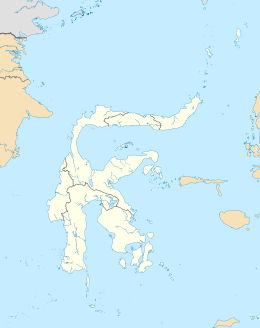
Menui Island (Pulau Menui in Indonesian), also written Manui Island, is located off the east coast of Sulawesi, Indonesia, in the waters of the Banda Sea. It is about 80 kilometers northwest from the city of Kendari.
 | |
| Geography | |
|---|---|
| Location | Banda Sea |
| Coordinates | 3°35′40″S 123°06′44″E / 3.5944°S 123.1122°E |
| Adjacent to | Sulawesi |
| Area | 112.6 km2 (43.5 sq mi) |
| Highest point | 267m |
| Demographics | |
| Population | 7,022 |
Geography
editMenui Island formed as an uplifted quaternary coral limestone island, and forms part of the Greater Sunda islands archipelago. The island is made up of karst formations, one of which is a large ridge that separates an uninhabited monsoonal dry forest in the south west of the island from the cleared and inhabitend northeast side.[1]
Demographics
editMenui Island has a population of 7,022 residents as of 2018. Ulunambo, the largest village which also serves as the seat of district government, has a population of 2,544.[2] The island has its own dialect of the Wawonii language which differs slightly from that spoken on larger nearby Wawonii Island.[3]
References
edit- ^ Monkhouse, J.R. (2018). "The avifauna of Menui Island, south-east Sulawesi, Indonesia". Retrieved November 18, 2024.
- ^ "Kecamatan Menui Kepulauan Dalam Angka 2019".
- ^ "Wawonii". Ethnologue. 18. 2015.
