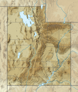
Moon Lake is a high mountain reservoir on the south slope of the High Uintas in Duchesne County, Utah. Recreation management is under the jurisdiction of the U.S. Forest Service, as the lake is part of the Ashley National Forest.
| Moon Lake | |
|---|---|
 Moon Lake Dam, 1938 | |
| Location | Duchesne County, Utah |
| Coordinates | 40°33′45″N 110°29′23″W / 40.562447°N 110.489606°W |
| Type | Reservoir |
| Basin countries | United States |
| Surface elevation | 8,087 ft (2,465 m)[1] |
| Website | Moon Lake Campground |
In 1938, the United States Bureau of Reclamation completed the earthen Moon Lake Dam on the Lake Fork River to expand the size of the existing natural lake for irrigation. The dam has a height of 98 feet, and the expanded reservoir a capacity of 49,500 acre-feet.[2][3]
Climate
edit| Climate data for Moon Lake, Utah, 1991–2020 normals: 8125ft (2477m) | |||||||||||||
|---|---|---|---|---|---|---|---|---|---|---|---|---|---|
| Month | Jan | Feb | Mar | Apr | May | Jun | Jul | Aug | Sep | Oct | Nov | Dec | Year |
| Mean daily maximum °F (°C) | 30.9 (−0.6) |
34.1 (1.2) |
40.6 (4.8) |
49.1 (9.5) |
58.6 (14.8) |
69.5 (20.8) |
77.3 (25.2) |
77.5 (25.3) |
67.5 (19.7) |
55.5 (13.1) |
40.1 (4.5) |
30.6 (−0.8) |
52.6 (11.5) |
| Daily mean °F (°C) | 18.9 (−7.3) |
23.1 (−4.9) |
29.2 (−1.6) |
36.3 (2.4) |
46.1 (7.8) |
54.6 (12.6) |
62.9 (17.2) |
63.5 (17.5) |
54.1 (12.3) |
43.3 (6.3) |
31.0 (−0.6) |
21.1 (−6.1) |
40.3 (4.6) |
| Mean daily minimum °F (°C) | 6.9 (−13.9) |
12.0 (−11.1) |
17.8 (−7.9) |
23.5 (−4.7) |
33.5 (0.8) |
39.7 (4.3) |
48.4 (9.1) |
49.4 (9.7) |
40.7 (4.8) |
31.1 (−0.5) |
21.9 (−5.6) |
11.5 (−11.4) |
28.0 (−2.2) |
| Source: NOAA[4] | |||||||||||||
Lakefork #1 is a SNOTEL weather station above Moon Lake, near the peak of Lake Fork Mountain, at an elevation of 10415 feet (3174 m).
| Climate data for Lakefork #1, Utah, 2006–2020 normals: 10415ft (3174m) | |||||||||||||
|---|---|---|---|---|---|---|---|---|---|---|---|---|---|
| Month | Jan | Feb | Mar | Apr | May | Jun | Jul | Aug | Sep | Oct | Nov | Dec | Year |
| Record high °F (°C) | 56 (13) |
54 (12) |
57 (14) |
62 (17) |
66 (19) |
75 (24) |
75 (24) |
76 (24) |
75 (24) |
66 (19) |
57 (14) |
54 (12) |
76 (24) |
| Mean maximum °F (°C) | 49.0 (9.4) |
47.1 (8.4) |
50.3 (10.2) |
55.8 (13.2) |
61.4 (16.3) |
69.8 (21.0) |
72.9 (22.7) |
70.9 (21.6) |
67.7 (19.8) |
58.8 (14.9) |
53.2 (11.8) |
47.8 (8.8) |
73.0 (22.8) |
| Mean daily maximum °F (°C) | 33.9 (1.1) |
32.7 (0.4) |
38.5 (3.6) |
42.8 (6.0) |
49.6 (9.8) |
60.5 (15.8) |
66.7 (19.3) |
64.5 (18.1) |
57.5 (14.2) |
46.8 (8.2) |
38.9 (3.8) |
31.5 (−0.3) |
47.0 (8.3) |
| Daily mean °F (°C) | 18.9 (−7.3) |
17.8 (−7.9) |
23.7 (−4.6) |
29.2 (−1.6) |
37.3 (2.9) |
47.0 (8.3) |
53.1 (11.7) |
50.9 (10.5) |
44.4 (6.9) |
34.6 (1.4) |
25.6 (−3.6) |
17.1 (−8.3) |
33.3 (0.7) |
| Mean daily minimum °F (°C) | 3.8 (−15.7) |
2.8 (−16.2) |
8.8 (−12.9) |
15.6 (−9.1) |
25.0 (−3.9) |
33.4 (0.8) |
39.5 (4.2) |
37.4 (3.0) |
31.3 (−0.4) |
22.4 (−5.3) |
12.2 (−11.0) |
2.8 (−16.2) |
19.6 (−6.9) |
| Mean minimum °F (°C) | −16.8 (−27.1) |
−17.8 (−27.7) |
−11.2 (−24.0) |
−3.1 (−19.5) |
9.8 (−12.3) |
23.8 (−4.6) |
32.0 (0.0) |
29.8 (−1.2) |
20.1 (−6.6) |
4.6 (−15.2) |
−9.8 (−23.2) |
−19.4 (−28.6) |
−22.9 (−30.5) |
| Record low °F (°C) | −30 (−34) |
−27 (−33) |
−16 (−27) |
−13 (−25) |
−2 (−19) |
16 (−9) |
28 (−2) |
24 (−4) |
15 (−9) |
−10 (−23) |
−23 (−31) |
−30 (−34) |
−30 (−34) |
| Average precipitation inches (mm) | 2.17 (55) |
2.34 (59) |
2.05 (52) |
2.34 (59) |
2.13 (54) |
1.40 (36) |
1.91 (49) |
2.28 (58) |
2.50 (64) |
2.42 (61) |
2.13 (54) |
2.36 (60) |
26.03 (661) |
| Source 1: XMACIS2[5] | |||||||||||||
| Source 2: NOAA (Precipitation)[6] | |||||||||||||
See also
editReferences
edit- ^ U.S. Geological Survey Geographic Names Information System: Moon Lake (Utah)
- ^ "Moon Lake Project". www.usbr.gov. Retrieved September 9, 2018.
- ^ Redmond, Zachary. "Moon Lake Project". US Bureau of Reclamation. Retrieved September 9, 2018.
- ^ "Moon Lake, Utah 1991-2020 Monthly Normals". Retrieved November 6, 2023.
- ^ "xmACIS2". National Oceanic and Atmospheric Administration. Retrieved November 15, 2023.
- ^ "Lakefork #1, Utah 1991-2020 Monthly Normals". Retrieved November 15, 2023.
Wikimedia Commons has media related to Moon Lake Dam.

