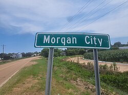
Morgan City, Mississippi is a town in Leflore County along Mississippi Highway 7. The population was 255 at the 2010 census,[2] down from 305 at the 2000 census. It is part of the Greenwood, Mississippi micropolitan area.
Morgan City, Mississippi | |
|---|---|
 | |
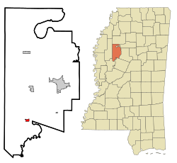
 Location of Morgan City, Mississippi | |
| Coordinates: 33°22′47″N 90°20′59″W / 33.37972°N 90.34972°W | |
| Country | United States |
| State | Mississippi |
| County | Leflore |
| Area | |
| • Total | 0.59 sq mi (1.52 km2) |
| • Land | 0.59 sq mi (1.52 km2) |
| • Water | 0.00 sq mi (0.00 km2) |
| Elevation | 118 ft (36 m) |
| Population (2020) | |
| • Total | 207 |
| • Density | 352.64/sq mi (136.19/km2) |
| Time zone | UTC-6 (Central (CST)) |
| • Summer (DST) | UTC-5 (CDT) |
| ZIP code | 38946 |
| Area code | 662 |
| FIPS code | 28-48800 |
| GNIS feature ID | 0673809 |
Geography
editMorgan City is located in southern Leflore County at 33°22′47″N 90°20′59″W / 33.37972°N 90.34972°W (33.379637, -90.349713).[3] Via Highway 7 it is 10 miles (16 km) south of Itta Bena and 16 miles (26 km) northeast of Belzoni. Greenwood, the Leflore county seat, is 16 miles (26 km) to the northeast of Morgan City.
According to the United States Census Bureau, the town has a total area of 0.58 square miles (1.5 km2), all land.[4] The town is 1.5 miles (2.4 km) northwest of the Yazoo River. Leflore County is part of the Mississippi Delta region.
Demographics
edit| Census | Pop. | Note | %± |
|---|---|---|---|
| 1970 | 207 | — | |
| 1980 | 319 | 54.1% | |
| 1990 | 139 | −56.4% | |
| 2000 | 305 | 119.4% | |
| 2010 | 255 | −16.4% | |
| 2020 | 207 | −18.8% | |
| U.S. Decennial Census[5] | |||
2020 Census
edit| Race / Ethnicity (NH = Non-Hispanic) | Pop 2000[6] | Pop 2010[7] | Pop 2020[8] | % 2000 | % 2010 | % 2020 |
|---|---|---|---|---|---|---|
| White alone (NH) | 50 | 48 | 33 | 16.39% | 18.82% | 15.94% |
| Black or African American alone (NH) | 245 | 203 | 169 | 80.33% | 79.61% | 81.64% |
| Native American or Alaska Native alone (NH) | 0 | 0 | 0 | 0.00% | 0.00% | 0.00% |
| Asian alone (NH) | 1 | 0 | 0 | 0.33% | 0.00% | 0.00% |
| Pacific Islander alone (NH) | 0 | 0 | 0 | 0.00% | 0.00% | 0.00% |
| Some Other Race alone (NH) | 0 | 0 | 0 | 0.00% | 0.00% | 0.00% |
| Mixed Race or Multi-Racial (NH) | 0 | 0 | 0 | 0.00% | 0.00% | 0.00% |
| Hispanic or Latino (any race) | 9 | 4 | 5 | 2.95% | 1.57% | 2.42% |
| Total | 305 | 255 | 207 | 100.00% | 100.00% | 100.00% |
2010 census
editAs of the 2010 United States Census, there were 255 people living in the town. The racial makeup of the town was 79.6% Black, 18.8% White and 1.6% were Hispanic or Latino of any race.
As of the census[9] of 2000, there were 305 people, 98 households, and 77 families living in the town. The population density was 530.7 inhabitants per square mile (204.9/km2). There were 101 housing units at an average density of 175.7 per square mile (67.8/km2). The racial makeup of the town was 16.39% White, 83.28% African American and 0.33% Asian. Hispanic or Latino of any race were 2.95% of the population.
There were 98 households, out of which 41.8% had children under the age of 18 living with them, 33.7% were married couples living together, 40.8% had a female householder with no husband present, and 21.4% were non-families. 21.4% of all households were made up of individuals, and 10.2% had someone living alone who was 65 years of age or older. The average household size was 3.11 and the average family size was 3.56.
In the town, the population was spread out, with 36.1% under the age of 18, 11.5% from 18 to 24, 25.2% from 25 to 44, 15.4% from 45 to 64, and 11.8% who were 65 years of age or older. The median age was 27 years. For every 100 females, there were 78.4 males. For every 100 females age 18 and over, there were 69.6 males.
The median income for a household in the town was $19,219, and the median income for a family was $17,917. Males had a median income of $20,375 versus $13,929 for females. The per capita income for the town was $9,465. About 33.8% of families and 42.6% of the population were below the poverty line, including 48.3% of those under the age of eighteen and 50.0% of those 65 or over.
Notable person
edit- Stewart Patridge, Conerly Trophy winning quarterback from the University of Mississippi
Education
editIt is in the Greenwood-Leflore School District.
The town was served by the Leflore County School District.[10] Effective July 1, 2019, this district consolidated into the Greenwood-Leflore School District.[11]
Musical significance
editMount Zion Missionary Baptist Church, founded in 1909 in the "Shellmound" area on the eastern edge of Morgan City, is the site of a large memorial marker (cenotaph) to blues legend Robert Johnson which was placed by the Mt. Zion Memorial Fund[12] through a major grant from Columbia Records and a number of smaller grants from organizations and individuals across the United States. The site now appears on numerous tour itineraries and is promoted by Leflore County.
References
edit- ^ "2020 U.S. Gazetteer Files". United States Census Bureau. Retrieved July 24, 2022.
- ^ "Total Population: 2010 Census DEC Summary File 1 (P1), Morgan City town, Mississippi". data.census.gov. U.S. Census Bureau. Retrieved April 6, 2020.
- ^ "US Gazetteer files: 2010, 2000, and 1990". United States Census Bureau. February 12, 2011. Retrieved April 23, 2011.
- ^ "U.S. Gazetteer Files: 2019: Places: Mississippi". U.S. Census Bureau Geography Division. Retrieved April 6, 2020.
- ^ "Census of Population and Housing". Census.gov. Retrieved June 4, 2015.
- ^ "P004 Hispanic or Latino, and Not Hispanic or Latino by Race – 2000: DEC Summary File 1 – Morgan City town, Mississippi". United States Census Bureau.
- ^ "P2 Hispanic or Latino, and Not Hispanic or Latino by Race – 2010: DEC Redistricting Data (PL 94-171) – Morgan City town, Mississippi". United States Census Bureau.
- ^ "P2 Hispanic or Latino, and Not Hispanic or Latino by Race – 2020: DEC Redistricting Data (PL 94-171) – Morgan City town, Mississippi". United States Census Bureau.
- ^ "U.S. Census website". United States Census Bureau. Retrieved January 31, 2008.
- ^ "SCHOOL DISTRICT REFERENCE MAP (2010 CENSUS): Leflore County, MS" (PDF). U.S. Census Bureau. Archived (PDF) from the original on May 13, 2021. Retrieved May 12, 2021.
- ^ "School District Consolidation in Mississippi Archived 2017-07-02 at the Wayback Machine." Mississippi Professional Educators. December 2016. Retrieved on July 2, 2017. Page 2 (PDF p. 3/6).
- ^ Andrew Buncombe (October 8, 2003). "I've never felt more like singin' the blues". The Independent.
