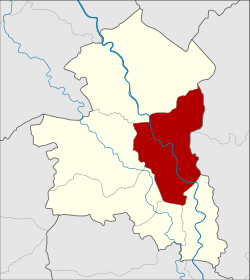
Mueang Sing Buri (Thai: เมืองสิงห์บุรี, pronounced [mɯ̄a̯ŋ sǐŋ bū.rīː]) is the capital district (amphoe mueang) of Sing Buri province, central Thailand.
Mueang Sing Buri
เมืองสิงห์บุรี | |
|---|---|
 District location in Singburi province | |
| Coordinates: 14°53′18″N 100°24′17″E / 14.88833°N 100.40472°E | |
| Country | Thailand |
| Province | Singburi |
| Area | |
• Total | 112.4 km2 (43.4 sq mi) |
| Population (2000) | |
• Total | 58,044 |
| • Density | 516.4/km2 (1,337/sq mi) |
| Time zone | UTC+7 (ICT) |
| Postal code | 16000 |
| Geocode | 1701 |
History
editMueang Sing was a city before the establishment of the Sukhothai Kingdom. The old city was founded in Tambon Chaksi. King Ramathibodi I (Uthong) of Ayutthaya Kingdom set Mueang Sing, Mueang In, and Mueang Phrom as the inner cities under Lopburi, the northern frontier city of Ayutthaya. In the reign of King Trailokanat, government administration was reformed and the three cities were downgraded to be level four cities (เมืองจัตวา) because they were not far from the capital of the kingdom. When Ayutthaya was conquered by Burmese troops, Sing Buri was the city of warlord Phraya Tak (later King Taksin the Great). In 1895 King Rama V settled Monthon Thesaphiban, Sing Buri was placed in Monthon Krungkao.
It became Mueang Sing Buri District in 1901, under the name Amphoe Bang Phutsa. In 1938 the government changed the name of the capital district to be the same as the name of the province.
Geography
editNeighboring districts are (from the north clockwise) In Buri of Singburi Province, Tha Wung of Lopburi province, Phrom Buri, Tha Chang, Khai Bang Rachan, and Bang Rachan of Sing Buri Province.
Administration
editThe district is divided into eight sub-districts (tambons).
| 1. | Bang Phutsa | บางพุทรา | |
| 2. | Bang Man | บางมัญ | |
| 3. | Phok Ruam | โพกรวม | |
| 4. | Muang Mu | ม่วงหมู่ | |
| 5. | Hua Phai | หัวไผ่ | |
| 6. | Ton Pho | ต้นโพธิ์ | |
| 7. | Chaksi | จักรสีห์ | |
| 8. | Bang Krabue | บางกระบือ |