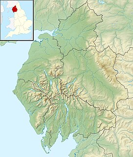
Murton Fell is a hill of 675 metres (2,215 ft) above the village of Murton, Cumbria in Eden district, in the North Pennines.[1][2] It lies east of the dramatic valley of High Cup Nick
| Murton Fell | |
|---|---|
 Stones near the summit | |
| Highest point | |
| Elevation | 675 m (2,215 ft)[1] |
| Prominence | 74 m (243 ft)[1] |
| Parent peak | Mickle Fell |
| Listing | Simm, Hewitt, Nuttall |
| Coordinates | 54°36′57″N 2°22′59″W / 54.615757°N 2.382965°W |
| Geography | |
| Location | North Pennines, England |
| Parent range | Lon: |
| OS grid | NY753245 |
| Topo map | OS Outdoor Leisure 19 |
It lies on the central watershed of England, as it is drained to the south west into the River Eden flowing into the Solway Firth, and to the north east into the River Tees and ultimately the North Sea.
References
edit- ^ a b c "Murton Fell". www.hill-bagging.co.uk. Retrieved 13 February 2021.
- ^ "Murton Fell, Eden - area information, map, walks and more". OS GetOutside. Retrieved 13 February 2021.

