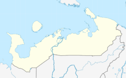
Nes (Russian: Несь) is a rural locality (a selo) in Zapolyarny District, Nenets Autonomous Okrug, Russia. It had a population of 1,368 as of 2010, a decrease from its population of 1,446 in 2002.
Nes
Несь | |
|---|---|
| Coordinates: 66°36′7″N 44°40′34″E / 66.60194°N 44.67611°E | |
| Country | Russia |
| Federal subject | Nenets Autonomous Okrug |
| Founded | 1769 |
| Elevation | 6 m (20 ft) |
| Population | |
• Total | 1,368 |
| Time zone | UTC+3 (MSK |
| Postal code(s)[3] | 166737 |
| Dialing code(s) | +7 81857 |
| OKTMO ID | 11811443101 |
Geography
editNes is located about 280 km southwest of Naryan-Mar and about 85 km northeast of Mezen, in the southern portion of the Kanin Peninsula. It is situated on the eponymous River Nes, about 12 km inland. Nes is barely north of the Arctic Circle.
History
editThe settlement first appeared as a fishing settlement in the second half of the 18th century. By the 1830s, the village had seven farmsteads. Its Orthodox church was built in 1831, but burned down 26 years later, in 1857.
Transport
editThere is no paved road to Nes, so the only way to get to and from the village is by air. The local airport serves flights to Arkhangelsk (Vaskovo Airport) and Naryan-Mar Airport.
Climate
editNes has a subarctic climate (Dfc).
References
edit- ^ Russian Federal State Statistics Service (2011). Всероссийская перепись населения 2010 года. Том 1 [2010 All-Russian Population Census, vol. 1]. Всероссийская перепись населения 2010 года [2010 All-Russia Population Census] (in Russian). Federal State Statistics Service.
- ^ "Об исчислении времени". Официальный интернет-портал правовой информации (in Russian). 3 June 2011. Retrieved 19 January 2019.
- ^ Почта России. Информационно-вычислительный центр ОАСУ РПО. (Russian Post). Поиск объектов почтовой связи (Postal Objects Search) (in Russian)


