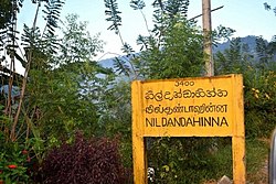
Nildandahinna (Sinhala: නිල්දණ්ඩාහින්න) is a town in Sri Lanka, located within Nuwara Eliya District. Nildandahinna Postal code is 22280. Also Sri Sumangala National College is located in Nildandahinna. Nildandahinna is administrated by Walapane Divisional Secretariat.
Nildandahinna
නිල්දණ්ඩාහින්න நில்தண்டாஹின்ன | |
|---|---|
Town | |
 Old Town sign of Nildandahinna | |
 | |
| Coordinates: 7°4′49″N 80°53′36″E / 7.08028°N 80.89333°E | |
| Country | Sri Lanka |
| Province | Central Province |
| District | Nuwara Eliya[1] |
| Divisional Secretariat[2] | Walapane[3] |
| Government | |
| • Type | Divisional Secretariat |
| • Body | Walapane[4] |
| Area | |
• Total | 1.663 km2 (0.642 sq mi) |
| Elevation | 1,060 m (3,444 ft) |
| Time zone | UTC+5:30 (Sri Lanka Time) |
| Postal codes | 22280 |
| Area code | 052 |
| Website | www |
Geography
edit- Area - 1.663 sq km
- Elevation 1060 m (3444 ft) above sea level
Climate
editNildandahinna is located above 1,060 metres (3,480 ft) above sea level. Nildandahinna has a tropical rainforest climate.[5] It is usually (very) warm, humid and rainy all year round. It is dry for 49 days a year with an average humidity of 84% and an UV-index of 6. The temperatures range from 24 °C to just 14 °C in Nildandahinna. The terrain is mostly mountainous, with deep valleys cutting into it. The two main mountain regions are the Pidurutalagala range.
Demographics
editThe population is only Sinhalese.[dubious – discuss][citation needed]
Administrative division
editVillages of Nildandahinna
edit- Thewatta
- Dabbare
- Wangu hatha
- Nildandahinna
- Rambuke
- Walaskale
See also
editReferences
edit- ^ http://www.nuwaraeliya.dist.gov.lk/
- ^ http://www.ds.gov.lk/
- ^ http://www.walapane.ds.gov.lk/index.php/en/
- ^ http://www.walapane.ds.gov.lk/index.php/en/
- ^ "Nildandahinna climate ☀️ Best time to visit 🌡️ Temperature". www.besttravelmonths.com. Retrieved 2023-01-21.
- "Grama Niladari Boundary Map of Sri Lanka". services.survey.gov.lk. Retrieved 2023-01-21.