You can help expand this article with text translated from the corresponding article in German. (July 2013) Click [show] for important translation instructions.
|
Pinkafeld (Hungarian: Pinkafő, Croatian: Pinkafelj, Slovene: Pinkafel, Romani: Pinkafa) is a city in Burgenland in Austria and the second largest settlement (after Oberwart) in the district Oberwart.
Pinkafeld | |
|---|---|
 Town hall | |
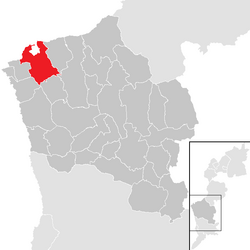
 Location within Oberwart district | |
| Coordinates: 47°22′N 16°7′E / 47.367°N 16.117°E | |
| Country | Austria |
| State | Burgenland |
| District | Oberwart |
| Government | |
| • Mayor | Kurt Maczek (SPÖ) |
| Area | |
• Total | 27.43 km2 (10.59 sq mi) |
| Elevation | 399 m (1,309 ft) |
| Population (2018-01-01)[2] | |
• Total | 5,779 |
| • Density | 210/km2 (550/sq mi) |
| Time zone | UTC+1 (CET) |
| • Summer (DST) | UTC+2 (CEST) |
| Postal code | 7423 |
| Website | www.pinkafeld-online.at |
Geography
editParts of the commune are Hochart, Gfangen, Alt-Pinkafeld, Nord-Pinkafeld and Pinkafeld Stadt. Pinkafeld lies on the course of the river Pinka, which gives the town its name.
History
edit- 860 - The first mention of Pinkafeld ("Peincahu")
- 1289 - The destruction of Pinkafeld ("Pinkafelde")
- 1397 - Pinkafeld is no longer part of Bernstein
- 1532 - The Ottomans destroy Pinkafeld
- 1658 - Ádám Batthyány constructs a castle in Pinkafeld
- 1921 - Pinkafeld becomes part of Austria, no longer under control by Hungary
Population
edit| Year | Pop. | ±% |
|---|---|---|
| 1697 | 1,500 | — |
| 1804 | 1,821 | +21.4% |
| 1844 | 2,351 | +29.1% |
| 1869 | 2,683 | +14.1% |
| 1880 | 3,080 | +14.8% |
| 1890 | 3,078 | −0.1% |
| 1900 | 3,156 | +2.5% |
| 1910 | 3,089 | −2.1% |
| 1923 | 2,776 | −10.1% |
| 1934 | 3,788 | +36.5% |
| 1939 | 3,695 | −2.5% |
| 1951 | 3,753 | +1.6% |
| 1961 | 4,081 | +8.7% |
| 1971 | 4,620 | +13.2% |
| 1981 | 4,792 | +3.7% |
| 1991 | 5,010 | +4.5% |
| 2001 | 5,181 | +3.4% |
| 2011 | 5,328 | +2.8% |
Politics
editThe mayor is Kurt Maczek of the SPÖ (Social Democratic Party of Austria). The vice-Mayor is Thomas Pickl of the ÖVP (Austrian People's Party). In the representation, which has 25 mandates, the SPÖ has 16 mandates and the ÖVP has 9.
Events
editIn 2012, the FCI European Open Junior Agility competition was hosted in Pinkafeld.
Notable people from Pinkafeld
edit- Ádám Batthyány (1610–1659), a Hungarian count of the Batthyány family; built a castle locally
- Carl Vaugoin (1873–1949), politician; eleventh Chancellor of Austria in 1930.
- Norbert Hofer (born 1971), an Austrian politician; raised in Pinkafeld
References
editWikimedia Commons has media related to Pinkafeld.
- ^ "Dauersiedlungsraum der Gemeinden Politischen Bezirke und Bundesländer - Gebietsstand 1.1.2018". Statistics Austria. Retrieved 10 March 2019.
- ^ "Einwohnerzahl 1.1.2018 nach Gemeinden mit Status, Gebietsstand 1.1.2018". Statistics Austria. Retrieved 9 March 2019.

