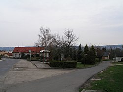
Plazy is a municipality and village in Mladá Boleslav District in the Central Bohemian Region of the Czech Republic. It has about 500 inhabitants.
Plazy | |
|---|---|
 Centre of Plazy | |
| Coordinates: 50°24′51″N 14°58′30″E / 50.41417°N 14.97500°E | |
| Country | |
| Region | Central Bohemian |
| District | Mladá Boleslav |
| First mentioned | 1322 |
| Area | |
• Total | 3.34 km2 (1.29 sq mi) |
| Elevation | 221 m (725 ft) |
| Population (2024-01-01)[1] | |
• Total | 509 |
| • Density | 150/km2 (390/sq mi) |
| Time zone | UTC+1 (CET) |
| • Summer (DST) | UTC+2 (CEST) |
| Postal code | 293 01 |
| Website | www |
Administrative parts
editThe village of Valy is an administrative part of Plazy.
Etymology
editThe name is derived from the word plaz. In old Czech it was an expression for a slippery path.[2]
Geography
editPlazy is located about 4 kilometres (2 mi) east of Mladá Boleslav and 47 km (29 mi) northeast of Prague. It lies in a flat agricultural landscape in the Jičín Uplands.
History
editThe first written mention of Plazy is from 1322.[3]
Demographics
edit
|
|
| ||||||||||||||||||||||||||||||||||||||||||||||||||||||
| Source: Censuses[4][5] | ||||||||||||||||||||||||||||||||||||||||||||||||||||||||
Economy
editIn the eastern part of the municipal territory there is an extensive industrial zone, which partially extends into the territory of neighbouring Mladá Boleslav. The largest company based here is the automotive parts manufacturer Faurecia Interior Systems Bohemia.[6]
Transport
editThe I/16 road (the section from Mladá Boleslav to Jičín) runs along the southern municipal border.
Sights
editThe main landmark of Plazy is the Church of Saints Simon and Jude. It is a Baroque church built in 1739. It replaced an old church, first mentioned in 1394, which was destroyed by the fall of the newly added tower in 1731.[3][7]
References
edit- ^ "Population of Municipalities – 1 January 2024". Czech Statistical Office. 2024-05-17.
- ^ Profous, Antonín (1951). Místní jména v Čechách III: M–Ř (in Czech). p. 373.
- ^ a b "Údaje o obci" (in Czech). Obec Plazy. Retrieved 2023-01-30.
- ^ "Historický lexikon obcí České republiky 1869–2011" (in Czech). Czech Statistical Office. 2015-12-21.
- ^ "Population Census 2021: Population by sex". Public Database. Czech Statistical Office. 2021-03-27.
- ^ "FORVIA Faurecia v ČR" (in Czech). Faurecia. Retrieved 2023-01-31.
- ^ "Kostel sv. Šimona a Judy" (in Czech). National Heritage Institute. Retrieved 2023-01-30.
External links
edit


