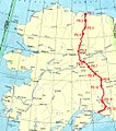
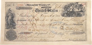
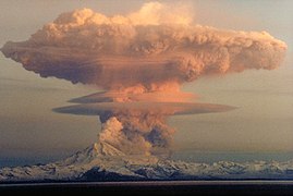
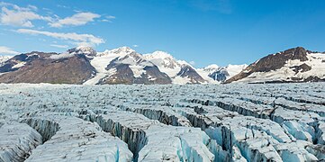
 Introduction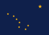   Alaska (/əˈlæskə/ ə-LASS-kə) is a non-contiguous U.S. state on the northwest extremity of North America. It is in the Western United States region. The only other non-contiguous U.S. state is Hawaii. Alaska is also considered to be the northernmost, westernmost, and easternmost (the Aleutian Islands cross the 180th meridian into the eastern hemisphere) state in the United States. To the east, it borders Canada (the Yukon territory, and the province of British Columbia). It shares a western maritime border, in the Bering Strait, with Russia's Chukotka Autonomous Okrug. The Chukchi and Beaufort Seas of the Arctic Ocean lie to the north, and the Pacific Ocean lies to the south. Technically a semi-exclave of the U.S., it is the largest exclave in the world. Alaska is the largest U.S. state by area, comprising more total area than the next three largest states of Texas, California, and Montana combined, and is the sixth-largest subnational division in the world. It is the third-least populous and most sparsely populated U.S. state, but is, with a population of 736,081 as of 2020, the continent's most populous territory located mostly north of the 60th parallel, with more than quadruple the combined populations of Northern Canada and Greenland. The state contains the four largest cities in the United States by area, including the state capital of Juneau. The state's most populous city is Anchorage, and approximately half of Alaska's residents live within its metropolitan area. Indigenous people have lived in Alaska for thousands of years, and it is widely believed that the region served as the entry point for the initial settlement of North America by way of the Bering land bridge. The Russian Empire was the first to actively colonize the area beginning in the 18th century, eventually establishing Russian America, which spanned most of the current state, and promoted and maintained a native Alaskan Creole population. The expense and logistical difficulty of maintaining this distant possession prompted its sale to the U.S. in 1867 for US$7.2 million (equivalent to $157 million in 2023). The area went through several administrative changes before becoming organized as a territory on May 11, 1912. It was admitted as the 49th state of the U.S. on January 3, 1959. Abundant natural resources have enabled Alaska—with one of the smallest state economies—to have one of the highest per capita incomes, with commercial fishing, and the extraction of natural gas and oil, dominating Alaska's economy. U.S. Armed Forces bases and tourism also contribute to the economy; more than half of the state is federally-owned land containing national forests, national parks, and wildlife refuges. It is among the most irreligious states, one of the first to legalize recreational marijuana, and is known for its libertarian-leaning political culture, generally supporting the Republican Party in national elections. The Indigenous population of Alaska is proportionally the second highest of any U.S. state, at over 15 percent, after only Hawaii. (Full article...) Entries here consist of Good and Featured articles, which meet a core set of high editorial standards.
 The military history of the Aleutian Islands began almost immediately following the purchase of Alaska from the Russian Empire by the United States in 1867. Prior to the early 20th century, the Aleutian Islands were essentially ignored by the United States Armed Forces, although the islands played a small role in the Bering Sea Arbitration when a number of British and American vessels were stationed at Unalaska to enforce the arbitrators' decision. By the early 20th century, a number of war strategies examined the possibility of conflict breaking out between the Empire of Japan and the United States. While the Aleutian Islands were seen as a potential staging point for invasions by either side, this possibility was dismissed owing to the islands' dismal climate. In 1922, the Washington Naval Treaty was signed, after which the United States Navy began to take an interest in the islands. However, nothing of significance was to materialize until World War II. In June 1942, the Imperial Japanese Navy invaded and captured Attu Island and Kiska. This marked the first time in 130 years that United States soil was under occupation by a hostile country and was the only two invasions of the United States during World War II. The Americans wanted to recapture the two islands, and in January the following year began their advance by capturing Amchitka without opposition. On March 26, the Battle of the Komandorski Islands ensued after the United States Navy imposed a naval blockade on the two islands to reduce the opportunities for the Japanese to keep their Attu and Kiska bases supplied. In May, Attu Island was recaptured, with a total of almost 3,000 deaths from both sides combined. The Americans then prepared to attack Kiska in August, only to find that the entire island had been evacuated by the Japanese in late July. During the recapture of Kiska by the United States, 92 men died as a result of friendly fire and a mine, despite no Japanese soldiers being present on the island. During the 1960s and early 1970s, the United States Atomic Energy Commission (AEC) executed a number of nuclear tests on the island of Amchitka in the face of vehement opposition from environmental and local indigenous groups. The first test, conducted in 1965, caused significant damage to the surrounding area, although the details of this damage were not released to the public until 1969. In 1969, the AEC executed a 'calibration shot' to determine whether Amchitka would be suitable for future tests. In 1970, the AEC announced plans to detonate a bomb named 'Cannikin', set to release a blast 385 times that released by the dropping of an atomic bomb on Hiroshima in 1945. After a United States Supreme Court challenge to the testing failed by one vote, the testing proceeded as scheduled in November 1971. (Full article...)TopicsCategoriesSelected article -Sitka Rocky Gutierrez Airport (IATA: SIT, ICAO: PASI, FAA LID: SIT) is a state-owned, public-use airport located west of the central business district of Sitka, a city and borough in the U.S. state of Alaska. The airport is named after Sitka's former mayor Rocky Gutierrez. It features a single terminal with jetway with air service operated year-round by Alaska Airlines and seasonally by Delta Air Lines regional affiliate Delta Connection operated by SkyWest Airlines. There is a single paved runway located on a causeway that juts off Japonski Island. Deceased tuberculosis patients from the nearby SEARHC/Mt. Edgecumbe Hospital were buried on airport grounds and had to be relocated during construction. That section of the airport is still unofficially called The Mausoleum. As per Federal Aviation Administration records, the airport had 68,197 passenger boardings (enplanements) in calendar year 2008, 62,498 enplanements in 2009, and 64,536 in 2010. It is included in the National Plan of Integrated Airport Systems for 2015-2019, which categorized it as a primary commercial service (nonhub) airport (more than 10,000 enplanements per year) based on 68,222 enplanements in 2012. (Full article...)Selected picture - Fairbanks and the Alaska Range at midday during the winter solstice, looking south from the hills above Farmers Loop Road. Photo credit: User: Joe n bloe General imagesThe following are images from various Alaska-related articles on Wikipedia.
Recognized content
Featured articlesGood articles
Featured pictures
Former featured pictures
Related Portals
Related WikiProjectsState facts
State symbols:
Tasks
Associated WikimediaThe following Wikimedia Foundation sister projects provide more on this subject:
Discover Wikipedia using portals |


