The Indiana Portal
Various indigenous peoples inhabited what would become Indiana for thousands of years, some of whom the U.S. government expelled between 1800 and 1836. Indiana received its name because the state was largely possessed by native tribes even after it was granted statehood. Since then, settlement patterns in Indiana have reflected regional cultural segmentation present in the Eastern United States; the state's northernmost tier was settled primarily by people from New England and New York, Central Indiana by migrants from the Mid-Atlantic states and adjacent Ohio, and Southern Indiana by settlers from the Upland South, particularly Kentucky and Tennessee.
Indiana has a diverse economy with a gross state product of $352.62 billion in 2021. It has several metropolitan areas with populations greater than 100,000 and a number of smaller cities and towns. Indiana is home to professional sports teams, including the NFL's Indianapolis Colts and the NBA's Indiana Pacers. The state also hosts several notable competitive events, such as the Indianapolis 500, held at Indianapolis Motor Speedway. (Full article...)
Selected article -
The COVID-19 pandemic reached the U.S. state of Indiana on March 5, 2020, and was confirmed on March 6. As of July 12, 2021, the Indiana State Department of Health (ISDH) had confirmed 757,904 cases in the state and 13,496 deaths. As of July 3, 2020, all 92 counties had reported at least 10 cases with Pike County being the last to surpass this threshold.
As of July 12, 2021, approximately 2.91 million Indiana residents were fully vaccinated, or about 43.2 percent of the population. (Full article...)
Selected image -
Did you know -
- ... that an Indiana newspaper donated its TV station to the local high school instead of shutting it down?
- ... that the 2020 case Henderson v. Box held that the state of Indiana must list same-sex parents on their child's birth certificate?
- ... that frontier physician Isaac Coe is credited with saving Indianapolis from an 1821 outbreak of malaria?
- ... that Gleaners Food Bank has served more than 700 million pounds (320 million kg) of food in Indiana?
- ... that the Circle Tower, an Art Deco building in Indianapolis, features ziggurat-like upper floors?
- ... that after becoming "convinced of the evils of slavery", James Townsend left Kentucky for Indiana?
Related portals
Selected geographic article -
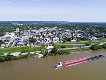
New Albany /ˈɑːlbəni/ is a city in Floyd County, Indiana, United States, situated along the Ohio River, opposite Louisville, Kentucky. The population was 37,841 as of the 2020 census. The city is the county seat of Floyd County. It is bounded by I-265 to the north and the Ohio River to the south, and is considered part of the Louisville, Kentucky Metropolitan Statistical Area. The mayor of New Albany is Jeff Gahan, a Democrat; he was re-elected in 2023. (Full article...)
Selected biography -
Levi Coffin (October 28, 1798 – September 16, 1877) was an American Quaker, Republican, abolitionist, farmer, businessman and humanitarian. An active leader of the Underground Railroad in Indiana and Ohio, some unofficially called Coffin the "President of the Underground Railroad", estimating that three thousand fugitive slaves passed through his care. The Coffin home in Fountain City, Wayne County, Indiana, is a museum, sometimes called the Underground Railroad's "Grand Central Station".
Born near what became Greensboro, North Carolina, Coffin was exposed to and came to oppose slavery as a child. His family immigrated to Indiana in 1826, avoiding slaveholders' increasing persecution of Quakers, whose faith did not permit them to own slaves and who assisted freedom seekers. In Indiana, Coffin settled near the National Road with other Quakers in Wayne County, Indiana, near the Ohio border. He farmed, as well as became a local merchant and business leader. Coffin became a major investor in and director of the local Richmond branch of the Second State Bank of Indiana in the 1830s, Richmond being the Wayne County seat. His financial position at the bank and standing in the community also helped supply food, clothing and transportation for Underground Railroad operations in the region. (Full article...)
Selected quote
General images
Topics
- Economy: AM General - ATA Airlines - Casinos - Cummins - Delta - ITT - JayC - Lilly - Limestone - Manufacturing - NiSource - Shoe Carnival - Simon Property Group - Soybeans - Studebaker - Vectren - WellPoint
- Geography: Caves - Lakes - Rivers - State forests - Watersheds
Categories
Attractions
 |
Recognized content
| This is a list of recognized content, updated weekly by JL-Bot (talk · contribs) (typically on Saturdays). There is no need to edit the list yourself. If an article is missing from the list, make sure it is tagged (e.g. {{WikiProject Indiana}}) or categorized correctly and wait for the next update. See WP:RECOG for configuration options. |
Good articles
- 1963 Indiana State Fairgrounds Coliseum gas explosion
- 2006 Brickyard 400
- 2011 South Bend mayoral election
- 2015 South Bend mayoral election
- 2019 South Bend mayoral election
- 2021 NCAA Division I men's basketball championship game
- Max Bielfeldt
- The Fault in Our Stars (film)
- Hurley Goodall
- R. Ames Montgomery
- Proposed South Shore Line station in South Bend
- Richmond, Indiana, facility fire
- WCAE
Featured pictures
-
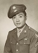
Kenje Ogata 1943
-
Kurt Vonnegut by Bernard Gotfryd (1965)
-
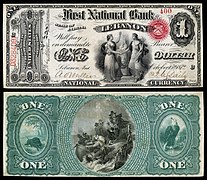
US-NBN-IL-Lebanon-2057-Orig-1-400-C
WikiProjects
State facts
Indiana | |
|---|---|
| Country | United States |
| Admitted to the Union | December 11, 1816 (19th) |
| Capital | Indianapolis |
| Largest city | Indianapolis |
| Largest metro and urban areas | Indianapolis-Carmel MSA |
| Government | |
| • Governor | Eric Holcomb (R) (2017) |
| • Lieutenant governor | Suzanne Crouch (R) (2017) |
| Legislature | Indiana General Assembly |
| • Upper house | Senate |
| • Lower house | House of Representatives |
| U.S. senators | Todd Young (R) Mike Braun (R) |
| Population | |
• Total | 6,080,485 |
| • Density | 169.5/sq mi (65.46/km2) |
| Language | |
| • Official language | English |
| Latitude | 37° 46′ N to 41° 46′ N |
| Longitude | 84° 47′ W to 88° 6′ W |
Things you can do
 |
Here are some tasks awaiting attention:
|
Associated Wikimedia
The following Wikimedia Foundation sister projects provide more on this subject:
-
Commons
Free media repository -
Wikibooks
Free textbooks and manuals -
Wikidata
Free knowledge base -
Wikinews
Free-content news -
Wikiquote
Collection of quotations -
Wikisource
Free-content library -
Wikiversity
Free learning tools -
Wikivoyage
Free travel guide -
Wiktionary
Dictionary and thesaurus
- ^ a b "Elevations and Distances in the United States". U.S Geological Survey. 29 April 2005. Retrieved 2006-11-06.
{{cite web}}: CS1 maint: year (link)


