Portal:Virginia/Selected articles
Selected articles
Nominations
Place the following on the page, which will automatically format the pieces:
{{Portal:Virginia/Selected articles/Layout
  |image=
  |size=
  |caption=
  |text=
  |link=
}}
The code for the above is available at Portal:Virginia/Selected articles/Layout.
1
Portal:Virginia/Selected article/1
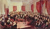
The Constitution of the Commonwealth of Virginia is the document that defines and limits the powers of the state government and the basic rights of the citizens of the U.S. Commonwealth of Virginia. Like all other state constitutions, it is supreme over Virginia's laws and acts of government, though it may be superseded by the United States Constitution and U.S. federal law as per the Supremacy Clause.The original Virginia Constitution of 1776 was enacted in conjunction with the Declaration of Independence by the first thirteen states of the United States of America. Virginia was the first state to adopt its own constitution, and the document was widely influential both in the United States and abroad. In addition to frequent amendments, there have been six major subsequent revisions of the constitution (in 1830, 1851, 1864, 1870, 1902, and the one currently in effect, in 1971). These new constitutions have been part of, and in reaction to, periods of major regional or social upheaval in Virginia. (1830 Virginia Constitutional Convention pictured)
2
Portal:Virginia/Selected article/2
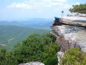
The Appalachian National Scenic Trail, generally known as the Appalachian Trail or simply the A.T., is a marked hiking trail in the eastern United States extending between Springer Mountain in Georgia and Mount Katahdin in Maine. The trail passes through the states of Georgia, North Carolina, Tennessee, Virginia, West Virginia, Maryland, Pennsylvania, New Jersey, New York, Connecticut, Massachusetts, Vermont, New Hampshire, and Maine.The precise length of the trail changes over time as trails are modified or added. The total length is approximately 2,200 miles (3,500 km). The path is maintained by 30 trail clubs and multiple partnerships, and managed by the National Park Service and the nonprofit Appalachian Trail Conservancy. The majority of the trail is in wilderness, although some portions traverse towns, roads and cross rivers.
The Appalachian Trail is famous for its many hikers, some of whom, called thru-hikers, attempt to hike it in its entirety in a single season. Many books, memoirs, web sites and fan organizations are dedicated to this pursuit.
3
Portal:Virginia/Selected article/3
Hurricane Isabel was the costliest and deadliest hurricane in the 2003 Atlantic hurricane season. The ninth named storm and fifth hurricane of the season, Isabel formed near the Cape Verde Islands from a tropical wave on September 6 in the tropical Atlantic Ocean. It moved northwestward and steadily strengthened to reach peak winds of 165 mph (265 km/h) on September 11. Isabel gradually weakened and made landfall on the Outer Banks of North Carolina with winds of 105 mph (165 km/h) on September 18, quickly weakening over land and became extratropical over western Pennsylvania the next day.The worst effects of Isabel occurred in Virginia, especially in the Hampton Roads area and along the shores of rivers as far west and north as Richmond and Washington, DC. Electric service was disrupted in areas of Virginia for several days, some more rural areas were without electricity for weeks, and local flooding caused thousands of dollars in damage. Overall, roughly six million people overall were left without electric service in the eastern United States and damage totalled about $5.7 billion (2003 USD, $9.44 billion 2024 USD). 16 deaths in seven U.S. states were directly related to the hurricane, with 35 deaths in six states and one Canadian province indirectly related to the hurricane.
4
Portal:Virginia/Selected article/4
The Battle of Great Bridge was fought December 9, 1775, in the area of Great Bridge, Virginia, early in the American Revolutionary War. The victory by Continental Army and militia forces led to the departure of Governor Lord Dunmore (pictured) and any remaining vestiges of British power from the Colony of Virginia during the early days of the conflict.Following increasing political and military tensions in early 1775, both Dunmore and rebellious Whig leaders recruited troops and engaged in a struggle for available military supplies. The struggle eventually focused on Norfolk, where Dunmore had taken refuge aboard a Royal Navy vessel. Dunmore's forces had fortified one side of a critical river crossing south of Norfolk at Great Bridge, while Whig forces had occupied the other side. In an attempt to break up the Whig gathering, Dunmore ordered an attack across the bridge, which was decisively repulsed. William Woodford, the Whig commander at the battle, described it as "a second Bunker's Hill affair".
Shortly thereafter, Norfolk, at the time a Tory center, was abandoned by Dunmore and the Tories, who fled to navy ships in the harbor. Whig-occupied Norfolk was destroyed on January 1, 1776 in an action begun by Dunmore and completed by Whig forces.
5
Portal:Virginia/Selected article/5
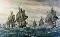
The Battle of the Chesapeake, also known as the Battle of the Virginia Capes, was a crucial naval battle in the American War of Independence that took place near the mouth of Chesapeake Bay on 5 September 1781, between a British fleet led by Rear Admiral Sir Thomas Graves and a French fleet led by Rear Admiral François Joseph Paul, comte de Grasse.Sailing south from New York with 19 ships of the line, Graves arrived at the mouth of the Chesapeake early on 5 September to see de Grasse's fleet of 24 ships of the line at anchor in the bay. De Grasse sailed out to meet Graves. In a two-hour engagement after hours of manoeuvring, the lines of the two fleets did not completely meet nor fully engage. The battle was consequently fairly evenly matched.
The battle was tactically inconclusive but strategically a major defeat for the British, since it prevented the Royal Navy from reinforcing or evacuating the blockaded forces of Lieutenant General Lord Cornwallis at Yorktown. As a result, Cornwallis surrendered his army after the Siege of Yorktown, resulting in negotiations that eventually resulted in peace and British recognition of the independent United States of America.
6
Portal:Virginia/Selected article/6
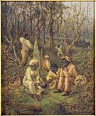
The Great Dismal Swamp maroons were freed and escaped slaves who inhabited the marshlands of the Great Dismal Swamp, an area of southeastern Virginia and northeastern North Carolina.At the beginning of the 18th century, maroons came to live in the swamp, most settling on mesic islands, the high and dry parts of the swamp. Inhabitants included slaves who had purchased their freedom, as well as escaped slaves. Other escaped slaves used the swamp as a route on the Underground Railroad as they made their way further north. Nearby whites often left enslaved maroons alone so long as they paid a quota in logs or shingles, and businesses may have ignored the fugitive nature of escaped slaves who provided work in exchange for trade goods.
Although conditions were harsh, research suggests that thousands lived there between about 1700 and the 1860s. While the precise number of maroons who lived in the swamp at that time is unknown, it is believed to have been one of the largest maroon colonies in the United States. Harriett Beecher Stowe told the maroon people's story in her 1856 novel Dred: A Tale of the Great Dismal Swamp.
7
Portal:Virginia/Selected article/7
The Gunpowder Incident (or Gunpowder Affair) was a conflict early in the American Revolutionary War between Lord Dunmore, the Royal Governor of the Colony of Virginia, and militia led by Patrick Henry.On the night of April 20, 1775, well before news of the Battles of Lexington and Concord on the prior day had reached Virginia, Lord Dunmore ordered the removal of the gunpowder from the magazine (pictured) in Williamsburg, Virginia, which stored it for the militia. Royal marines went to loaded fifteen half barrels of powder into the governor's wagon, and began transporting it to the Royal Navy ship Magdalen in the James River.
The act was discovered by townsfolk while underway, and they sounded an alarm. Local militia rallied to the scene, and riders spread word of the incident across the colony. Patrick Henry led a small militia force toward Williamsburg to force return of the gunpowder to the colony's control, arguing that it was owned by the colony and not the Crown. The matter was resolved without conflict when a payment of £330 was made to Henry. Fearing for his personal safety after the incident, Dunmore later retreated to a naval vessel, ending of royal control of the colony.
8
Portal:Virginia/Selected article/8
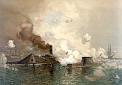
The Battle of Hampton Roads was the most noted and arguably most important naval battle of the American Civil War from the standpoint of naval technology. It was fought over two days, March 8–9, 1862, in Hampton Roads. The battle was a part of the effort of the Confederacy to break the Union blockade, which had cut off Virginia's largest cities from international trade.On the first day, the Confederate ironclad ram CSS Virginia (built from the remnants of the USS Merrimack), opposed only by conventional, wooden-hulled ships, destroyed two ships and damaged a third. During the night, the USS Monitor arrived. The two ironclads fought for about three hours, with neither being able to inflict significant damage on the other. The duel ended indecisively, the ships did not fight again, and the blockade remained in place.
The major significance of the battle is that it was the first meeting in combat of ironclad warships. It received worldwide attention; Great Britain and France halted further construction of wooden-hulled ships, and others followed suit. The use of a small number of very heavy guns, mounted so that they could fire in all directions, was first demonstrated by Monitor, and soon became standard in warships of all types.
9
Portal:Virginia/Selected article/9
The Chincoteague Pony, also known as the Assateague horse, is a breed of pony that developed and lives in a feral condition on Assateague Island in the United States states of Virginia and Maryland. The breed was made famous by the Misty of Chincoteague series written by Marguerite Henry starting in 1947. While phenotypically horse-like, they are commonly called "ponies". This is due in part to their smaller stature, created by the poor habitat present on Assateague Island. Island Chincoteagues live on a diet of salt marsh plants and brush. Although popularly known as Chincoteague ponies, the feral ponies actually live on Assateague Island.Several legends are told regarding their origins, the most likely that they descend from stock released on the island by colonists looking to escape livestock laws and taxes on the mainland. In 1835, the practice of pony penning began, rounding up ponies and removing some of them to the mainland. In 1924 the first official "Pony Penning Day" was held by the Chincoteague Volunteer Fire Company, where ponies were auctioned as a way to raise money for fire equipment, an annual event that continues to the present day.
10
Portal:Virginia/Selected article/10
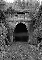
The Virginia Central Railroad was an early railroad in the U.S. state of Virginia that operated between 1850 and 1868 from Richmond westward for nearly 200 miles (320 km) to Covington. Chartered in 1836 as the Louisa Railroad by the Virginia General Assembly, the railroad began near the Richmond, Fredericksburg and Potomac Railroad's line and expanded westward, reaching Gordonsville by 1840, and the base of the Blue Ridge in 1852. Renamed the Virginia Central Railroad, the railroad used a temporary track built over Rockfish Gap until the completion of the Blue Ridge Tunnel, connecting it with the Shenandoah Valley.The railroad faced significant action against it during the American Civil War as a prime target for raids by Union Cavalry Although the war left the railroad with only a fraction of its line left operable, the railroad was running over its entire pre-war length by July 1865. In 1868, the Chesapeake and Ohio Railroad was formed from the merger of the Virginia Central Railroad and the Covington and Ohio Railroad, expanding westward to the Ohio River by 1873. Today, CSX, Amtrak, and the Buckingham Branch Railroad still use portions of the old Virginia Central line for freight and passenger rail service.
11
Portal:Virginia/Selected article/11
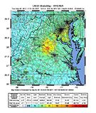
The 2011 Virginia earthquake occurred on August 23, 2011, at 1:51 pm EDT (17:51 UTC) in the Piedmont region of the US state of Virginia. The epicenter, in Louisa County, was 38 mi (61 km) northwest of Richmond and 5 mi (8 km) south-southwest of the town of Mineral. It was an intraplate earthquake with a magnitude of 5.8 and a maximum perceived intensity of VII (very strong) on the Mercalli intensity scale. Several aftershocks, ranging up to 4.5 Mw in magnitude, occurred after the main tremor.The earthquake, along with a magnitude–5.8 quake on the New York–Ontario border during 1944, is the largest to have occurred in the U.S. east of the Rocky Mountains since an earthquake centered in Giles County in western Virginia occurred during 1897, with an estimated magnitude of 5.8. The quake was felt across more than a dozen U.S. states and in several Canadian provinces, and was felt by more people than any other quake in U.S. history. No deaths and only minor injuries were reported. Minor damage to buildings was widespread and was estimated by one risk-modeling company at $200 million to $300 million, of which about $100 million was insured.
12
Portal:Virginia/Selected article/12
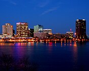
Norfolk is an independent city in the Commonwealth of Virginia in the United States. With a population of 245,803 as of the 2012 Cooper Center population estimates, it is Virginia's second-largest city behind neighboring Virginia Beach.Norfolk is located at the core of the Hampton Roads metropolitan area, named for the large natural harbor of the same name located at the mouth of Chesapeake Bay. It is one of nine cities and seven counties that constitute the Hampton Roads metro area, officially known as the Virginia Beach-Norfolk-Newport News, VA-NC MSA. The city is bordered to the west by the Elizabeth River and to the north by the Chesapeake Bay. It also shares land borders with the independent cities of Chesapeake to its south and Virginia Beach to its east. One of the oldest of the cities in Hampton Roads, Norfolk is considered to be the historic, urban, financial, and cultural center of the region.
The city has a long history as a strategic military and transportation point. Norfolk Naval Base is the world's largest such base, and the world's largest military alliance, the North Atlantic Treaty Organization has one of its two Strategic Command headquarters here. The city also has the corporate headquarters of Norfolk Southern Railway, one of North America's principal Class I railroads, and Maersk Line, Limited, who manages the world's largest fleet of US-flag vessels. As the city is bordered by multiple bodies of water, Norfolk has many miles of riverfront and bayfront property. It is linked to its neighbors by an extensive network of Interstate highways, bridges, tunnels, and three bridge-tunnel complexes—the only bridge-tunnels in the United States.
13
Portal:Virginia/Selected article/13
The Siege of Yorktown, or Surrender of Yorktown, the latter taking place on October 19, 1781, was a decisive victory by a combined force of American Continental Army troops led by General George Washington and French Army troops led by the Comte de Rochambeau over a British Army commanded by Lieutenant General Lord Cornwallis. The culmination of the Yorktown campaign, it proved to be the last major land battle of the American Revolutionary War in North America.French and American armies united north of New York City during the summer of 1781, moving south toward Virginia. The Comte de Grasse arrived at the Chesapeake Bay at the end of August, bringing troops and providing a naval blockade of Yorktown, after which the Americans and French built their first parallel and began the bombardment. With the British defense weakened, on October 14, 1781 Washington sent two columns to attack the last major remaining British outer defenses. The British situation began to deteriorate rapidly and Cornwallis asked for capitulation terms on the 17th. The surrender ceremony took place on the 19th; Lord Cornwallis, claiming to be ill, was absent from the ceremony. Negotiations between the United States and Great Britain began, resulting in the Treaty of Paris in 1783.
14
Portal:Virginia/Selected article/14
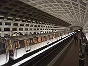
The Washington Metro, commonly called Metro, and unofficially Metrorail, is the rapid transit system in Washington, D.C., and its surrounding suburbs. It is administered by the Washington Metropolitan Area Transit Authority (WMATA), which also operates Metrobus service under the Metro name. In Maryland, Metro provides service to Montgomery County and Prince George's County; in Virginia, to Fairfax County, Arlington County, and the City of Alexandria. Since opening in 1976, the network has grown to include five lines, 86 stations, and 106.3 miles (171.1 km) of track.Metro is the second-busiest rapid transit system in the United States in number of passenger trips, after the New York City Subway. There were 215.3 million trips, or 727,684 trips per weekday, on Metro in fiscal year 2008. In June 2008, Metro set a new monthly ridership record with 19,729,641 trips, or 798,456 per weekday.
Most Metro stations were designed by Chicago architect Harry Weese, and are examples of late-20th century modern architecture. With their heavy use of exposed concrete and repetitive design motifs, Metro stations also display aspects of brutalist design. In 2007, the design of the Metro's vaulted-ceiling stations was voted number 106 on the American Institute of Architects' "America's Favorite Architecture" list.
15
Portal:Virginia/Selected article/15 The Pittston Coal strike was a United States labor union action led by the United Mine Workers Union (UMWA) against the Pittston Coal Company, nationally headquartered in Pittston, Pennsylvania. The strike, which lasted from April 5, 1989 to February 20, 1990, resulted from Pittston's termination of health care benefits for approximately 1,500 retirees, widows, and disabled miners. The strikers also cited the refusal of the company to contribute to the benefit trust established in 1950 for miners who retired before 1974 and the refusal of the company to bargain in good faith as grounds for their action. The company cited declining coal prices, decreasing demand, and recession as its reason for limiting health care benefits.
The strike affected production in mines mostly in Virginia, but a few in West Virginia and Kentucky as well. Mine workers and their families engaged in acts of civil disobedience, work stoppage, protests, and rallies. At its peak in June 1989, the strike involved approximately 2,000 miners daily staying at Camp Solidarity with thousands more sending donations and holding wildcat walkouts that involved around 40,000 people. The participation of women in the labor action through the ad hoc formation of the Daughters of Mother Jones—reminiscent of the early days of union organization—proved an essential element of the successful strike.
16
Portal:Virginia/Selected article/16
The Battle of Blandford (or Blanford), also called the Battle of Petersburg, took place near Petersburg, Virginia on 25 April 1781, late in the American War of Independence. Roughly 2,300 British regulars under the command of Brigadier General William Phillips defeated about 1,000 militia under Major General Baron von Steuben.The introduction of a British troop presence led by turncoat general Benedict Arnold into Virginia in early 1781 prompted an increase in militia activity to counter the British force. The militia were, however, poorly trained and equipped, and were unable to prevent Arnold from moving freely. Arnold was reinforced in March 1781 by additional troops led by General Phillips, who targeted Petersburg in a raiding expedition. Militia forces led by von Steuben and Peter Muhlenberg decided to make a stand at Blandford, then a separate community.
When the battle was joined, the outnumbered militia provided remarkably stiff resistance to the British advance, and executed a disciplined retreat across the Appomattox River, avoiding a flanking attempt led by John Graves Simcoe. They eventually retreated to Richmond, where they joined forces with Continental Army troops led by the Marquis de Lafayette. The British continued raiding, and eventually joined forces with Charles Cornwallis's army from North Carolina.
17
Portal:Virginia/Selected article/17
Fort Jackson was an American Civil War-era fortification in Virginia that defended the southern end of the Long Bridge, near Washington, D.C. Long Bridge connected Washington, D.C. to Northern Virginia and served as a vital transportation artery for the Union Army during the war. Fort Jackson was named for Jackson City, a seedy suburb of Washington that had been established on the south side of the Long Bridge in 1835. It was built in the days immediately following the Union Army's occupation of Northern Virginia in May 1861. The fort was initially armed with four cannon used to protect the bridge, but these were removed after the completion of the Arlington Line, a line of defenses built to the south. After 1862, the fort lacked weapons except for small arms and consisted of a wooden palisade backed by earthworks. Two cannon were restored to the fort in 1864 following the Battle of Fort Stevens. The garrison consisted of a single company of Union soldiers who inspected traffic crossing the bridge and guarded it from potential saboteurs.Following the final surrender of the Confederate States of America in 1865, Fort Jackson was abandoned. The lumber used in its construction was promptly salvaged for firewood and construction materials and, due to its proximity to the Long Bridge, the earthworks were flattened in order to provide easier access to Long Bridge. In the early 20th century, the fort's site was used for the footings and approaches to several bridges connecting Virginia and Washington. Today, no trace of the fort remains, though the site of the fort is contained within Arlington County's Long Bridge Park, and a National Park Service 2004 survey of the site indicated some archaeological remnants may still remain beneath the park.
18
Portal:Virginia/Selected article/18
The Charlottesville and Albemarle Railway (C&A) was a short electric street railroad operating within the city of Charlottesville, Virginia, United States during the early 20th century. The line was preceded by several streetcar lines operating both horse-drawn and electric powered cars dating back to 1887. After facing financial difficulties, the predecessor lines were reorganized into the C&A in 1903. The C&A's electric streetcars operated off of an overhead line system that was powered by the railroad's own power plant. The C&A also offered electric power generated by its plant to the city of Charlottesville. During the mid-1910s, the line received numerous upgrades, including the construction of a new power plant on the Rivanna River, a new company headquarters building, expansion of track, and the purchase of new streetcars.Increased expenses and decreasing ridership, coupled with the Great Depression, caused the railway to cease streetcar operations in 1935. The railway was reorganized as the Charlottesville and Albemarle Bus Company in 1936 with a transition to bus service. Today, Charlottesville Area Transit provides bus service to the city of Charlottesville. The city has recently investigated the feasibility of a streetcar line following much of the same route as the Charlottesville and Albemarle Railway.
19
Portal:Virginia/Selected article/19
The Stanley plan was a package of 13 statutes adopted in September 1956 by the U.S. state of Virginia designed to ensure racial segregation in that state's public schools despite the ruling of the Supreme Court of the United States in Brown v. Board of Education of Topeka, Kansas, 347 U.S. 483 (1954). The legislative program was named for Governor Thomas B. Stanley, who proposed the program and successfully pushed for its enactment. The Stanley plan was a critical element in the policy of "massive resistance" to the Brown ruling advocated by U.S. Senator Harry F. Byrd, Sr. (pictured). The plan also included measures designed to curb the Virginia state chapter of the National Association for the Advancement of Colored People (NAACP), which many Virginia segregationists believed was responsible for "stirring up" litigation to integrate the public schools.The plan was enacted by the Virginia Assembly on September 22, 1956, and signed into law by Governor Stanley on September 29. A federal court struck down a portion of the Stanley plan as unconstitutional in January 1957. By 1960, nearly all of the major elements of the plan (including the litigation curbs aimed at the NAACP) had been struck down by the U.S. Supreme Court and other federal and state courts. The constitutional invalidity of the Stanley plan led new governor of Virginia, James Lindsay Almond, Jr., to propose "passive resistance" to school integration in 1959. The Supreme Court declared portions of "passive resistance" unconstitutional in 1964 and again in 1968.
20
Portal:Virginia/Selected article/20
The Battle of Green Spring took place near Green Spring Plantation in James City County, Virginia during the American Revolutionary War. On July 6, 1781 United States Brigadier General "Mad" Anthony Wayne, leading the advance forces of the Marquis de Lafayette, was ambushed near the plantation by the British army of Earl Charles Cornwallis in the last major land battle of the Virginia campaign prior to the Siege of Yorktown.Following a month of marching and countermarching in central Virginia by Cornwallis and Lafayette, Cornwallis in late June moved to Williamsburg, where he received orders to move to Portsmouth. Lafayette followed Cornwallis fairly closely. On July 4, Cornwallis departed Williamsburg for Jamestown, planning to cross the James River en route to Portsmouth. Lafayette believed he could stage an attack on Cornwallis's rear guard during the crossing.
Cornwallis anticipated Lafayette's idea, and laid an elaborate trap. General Wayne's forces were very nearly caught in the trap, and only a bold bayonet charge against the numerically overwhelming British enabled his forces to retreat. Cornwallis did not follow the victory with pursuit, instead following his plan to cross the river. The action reinforced the perception among contemporaries that justified the moniker "Mad" to describe Wayne, although opinion on the merits of his actions was divided.
21
Portal:Virginia/Selected article/21
Virginia Beach is an independent city located in the Hampton Roads metropolitan area of the Commonwealth of Virginia, on the Atlantic Ocean at the mouth of the Chesapeake Bay. Although Fairfax County is the most populous jurisdiction in the state, Virginia Beach is the most populous city in the state, as well as the 39th largest city in the United States, with a population of 447,489 in 2012. Virginia Beach is the easternmost city of the Hampton Roads area that makes up the core of the Virginia Beach-Norfolk-Newport News, VA-NC MSA.Virginia Beach is a resort city with miles of beaches and hundreds of hotels, motels, and restaurants along its oceanfront. Every year the city hosts the East Coast Surfing Championships as well as the North American Sand Soccer Championship, a beach soccer tournament. It is also home to several state parks, several long-protected beach areas, three military bases, a number of large corporations, two universities, Edgar Cayce's Association for Research and Enlightenment, and numerous historic sites. Near the point where the Chesapeake Bay and the Atlantic Ocean meet, Cape Henry was the site of the first landing of the English colonists, who eventually settled in Jamestown.
The city is listed in the Guinness Book of Records as having the longest pleasure beach in the world. It is located at the southern end of the Chesapeake Bay Bridge-Tunnel, the longest bridge-tunnel complex in the world.
22
Portal:Virginia/Selected article/22
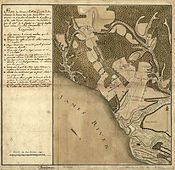
Newport News is an independent city located in the Hampton Roads metropolitan area of Virginia. It is at the southeastern end of the Virginia Peninsula, on the northern shore of the James River extending southeast from Skiffe's Creek along many miles of waterfront to the river's mouth at Newport News Point on the harbor of Hampton Roads.The area now known as Newport News was once a part of Warwick County, one of the eight original shires of Virginia. In 1881, 15 years of explosive development began under the leadership of Collis P. Huntington, whose new Peninsula Extension of the Chesapeake and Ohio Railway from Richmond opened up transportation along the Peninsula and provided a new pathway for the railroad to bring West Virginia bituminous coal to port for coastal shipping and worldwide export. With the new railroad came a terminal and coal piers where the colliers were loaded. Within a few years, Huntington and his associates also built a large shipyard. In 1896, Newport News was incorporated as a town. In 1958, by mutual consent by referendum, Newport News was consolidated with the former Warwick County, rejoining the two localities to approximately their pre-1896 geographic size. The more widely known name of Newport News was selected as they formed what was then Virginia's third largest independent city in population. As of 2012, the city population was 183,331 ranking it as Virginia's fifth largest incorporated city by population.
With many residents employed at the expansive Huntington Ingalls Shipbuilding, the joint U.S. Air Force-U.S. Army installation at Joint Base Langley–Eustis, and other military bases and suppliers, the city's economy is very connected to the military, together with continued importance as a shipping hub through the Newport News Marine Terminals.
23
Portal:Virginia/Selected article/23
At the Battle of Malvern Hill (July 1, 1862) during the American Civil War, the Confederate Army of Northern Virginia under the command of General Robert E. Lee and the Union Army of the Potomac under General George B. McClellan clashed near Richmond, Virginia, the Confederate capital.Confederate commander-in-chief Joseph E. Johnston had fended off McClellan's repeated attempts to take the city of Richmond as part of McClellan's ambitious Peninsula Campaign. After Johnston was wounded, Lee took command and launched a series of counterattacks, collectively called the Seven Days Battles, culminating in the action on Malvern Hill. The battle involved over fifty thousand soldiers from each side, hundreds of pieces of artillery and three warships. The Union V Corps, under Fitz John Porter, took up positions on the hill on June 30 in preparation for the battle, which began the following day. Confederate preparations were hindered by several mishaps. Nonetheless, the Confederates attacked first, when the artillery on the left flank began firing upon the Union line. The Federal artillery, however, was the story of the day, repulsing attack after attack.
In the aftermath of the battle, the Confederate press heralded Lee as the savior of Richmond. McClellan was criticized harshly for his absence from the battlefield, an issue that would haunt him when he ran for president in 1864. From Malvern Hill, McClellan and his forces withdrew to Harrison's Landing where he would stay until August 16. Lee withdrew to Richmond to prepare for his next operation, as the action on Malvern Hill ended the campaign on the Peninsula.
24
Portal:Virginia/Selected article/24
Virginia House is a country house on a hillside overlooking the James River in the Windsor Farms neighborhood of Richmond, Virginia.The house was constructed from the materials of the 16th century Warwick Priory in Warwickshire, England, and shipped over and reassembled, completed several months before the stock market crash of 1929. Virginia House is in the Tudor architectural style but incorporates a range of designs from other English houses and has modern facilities such as seven baths and central heating.
Virginia House belonged to Alexander and Virginia Weddell, an interior designer who had created a lavish interior for the house, salvaging many materials from the priory and other old English manor houses and adding further elegant English and Spanish antiques, oriental carpets, silks and silverware. Today Virginia House is operated by the Virginia Historical Society as a museum, although it largely remains as it was in the 1930s except for gradual crumbling sandstone replacement. Immediately to the west of the property is Agecroft Hall.
25
Portal:Virginia/Selected article/25
Skyline Drive is a 105-mile (169 km) road that runs the entire length of the National Park Service's Shenandoah National Park in the Blue Ridge Mountains of Virginia, generally along the ridge of the mountains. The drive's northern terminus is at an intersection with U.S. Route 340 (US 340) near Front Royal, and the southern terminus is at an interchange with US 250 in Rockfish Gap, where the road continues south as the Blue Ridge Parkway.A park entrance fee is charged at the four access points to the drive. Skyline Drive is a two-lane road that has 75 overlooks providing views of the Shenandoah Valley to the west and the Piedmont to the east. The drive provides access to numerous trails, including the Appalachian Trail, and it is also used for biking and horseback riding. Skyline Drive is the main road through Shenandoah National Park and has access to campgrounds, visitor centers, and resorts such as Skyland Resort and Big Meadows. The scenic drive is particularly popular in the fall for leaf peeping when the leaves are changing colors. Skyline Drive is designated a National Scenic Byway and a National Historic Landmark and is listed on the National Register of Historic Places.
Plans for the road date back to 1924 when a national park was planned in the Blue Ridge Mountains of Virginia and the main feature was to be a "sky-line drive" providing views of the surrounding land. Groundbreaking for Skyline Drive took place in 1931. The first section, which originally was to run from Rapidan Camp to Skyland, was extended between Swift Run Gap and Thornton Gap and opened in 1934. The Civilian Conservation Corps played a large part in constructing Skyline Drive. Improvements have been made to the roadway since it was built. Skyline Drive was added to the National Register of Historic Places in 1997, became a National Scenic Byway in 2005, and was designated a National Historic Landmark in 2008.
