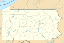
Punxsutawney Municipal Airport is a small regional non-towered airport located 3 miles North-East of Punxsutawney, Pennsylvania.[1]
Punxsutawney Municipal Airport | |||||||||||||||
|---|---|---|---|---|---|---|---|---|---|---|---|---|---|---|---|
| Summary | |||||||||||||||
| Airport type | Public | ||||||||||||||
| Owner | Punxsutawney Airport Authority | ||||||||||||||
| Location | Punxsutawney, Pennsylvania | ||||||||||||||
| Opened | October 4, 1929 | ||||||||||||||
| Elevation AMSL | 1,439 ft / 438.6 m | ||||||||||||||
| Coordinates | 40°58′00″N 078°55′45″W / 40.96667°N 78.92917°W | ||||||||||||||
| Map | |||||||||||||||
 | |||||||||||||||
| Runways | |||||||||||||||
| |||||||||||||||
| Statistics (2015) | |||||||||||||||
| |||||||||||||||
The airport has never had schedule airliner traffic throughout its history. It is designated by the Federal Aviation Administration as a low traffic regional non commercial airport. In 2014 the airport had a little over 11,000 aircraft operations. It is not unusual to see few or no aircraft arrivals or departures from the airport over the course of a day.[2]
As designated by the FAA in 2015 the airport had 10 based aircraft, all fixed wing single engine airplanes. That same year the aircraft chart had 77% local general aviation, 19% transient general aviation and 4% military.[3]
The airport was opened on October 4, 1929, at the time it was a single grass landing strip. Approximately 1,000 locals were in attendance when the airport was dedicated. In the late 70s or early 80s runway 6/24 was built the only asphalt runway at the airport.
See also
editReferences
edit- ^ "N35 - Punxsutawney Municipal Airport | SkyVector". skyvector.com. Retrieved 2017-06-30.
- ^ "Punxsutawney Municipal Airport Authority FBO Info & Fuel Prices at Punxsutawney Muni (N35) ✈ FlightAware". FlightAware. Retrieved 2017-06-30.
- ^ "Punxsutawney Municipal Airport - AIRNAV". AirNav. Retrieved 30 June 2017.

