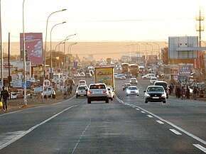
The R568 is a Regional Route in South Africa that connects Siyabuswa with Bronkhorstspruit via KwaMhlanga.[1]
| Regional route R568 | ||||
|---|---|---|---|---|
 R568 in KwaMhlanga, western Mpumalanga | ||||
| Route information | ||||
| Length | 106 km (66 mi) | |||
| Major junctions | ||||
| North end | ||||
| South end | ||||
| Location | ||||
| Country | South Africa | |||
| Major cities | Siyabuswa, KwaMhlanga, Ekangala, Bronkhorstspruit | |||
| Highway system | ||||
| ||||
Route
editIts north-eastern terminus is an intersection with the R573 at Siyabuswa, Mpumalanga. It initially heads west, then south-west, again crossing the R573 at KwaMhlanga. It then heads south, passing through Loopspruit before crossing into Gauteng and passing through Ekangala. South of Ekangala, it co-signs with the R513 for 2.5 kilometres and then crosses the R104 and N4 highway (Maputo Corridor) just west of Bronkhorstspruit. It then ends at an intersection with the R25.[1]
References
edit- ^ a b Falkner, John (May 2012). South African Numbered Route Description and Destination Analysis (Report). National Department of Transport. pp. 1–6. Archived from the original on 6 June 2014. Retrieved 27 January 2014.
