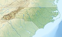
Rich Mountain is a mountain located in the North Carolina High Country, roughly 3 miles (4.8 km) northwest of the town of Boone. Its elevation reaches 4,748 feet (1,447 m).
| Rich Mountain | |
|---|---|
| Highest point | |
| Elevation | 4,748 ft (1,447 m)[1] |
| Coordinates | 36°14′08″N 81°42′21″W / 36.23556°N 81.70583°W[1] |
| Geography | |
| Location | Watauga County, North Carolina, U.S. |
| Parent range | Blue Ridge Mountains |
| Topo map | USGS Boone |
The mountain is sometimes confused with Howard Knob, which is to its immediate east; sharing the same ridge to the west is Snakeden Mountain. The summit is private property.
The summit of Rich Mountain has year-round temperatures similar to nearby Beech Mountain. While Beech Mountain stands 800 feet (240 m) taller, the unique environment and prevailing winds that channel through a valley just to the North of Rich, bring winter lows that compete with and are occasionally lower than Beech[citation needed]. The summit, and upper north face of Rich Mountain will also receive 50-90% more snow each winter than Boone.[citation needed] 68" of snow was recorded during the 2017/2018 winter which sported 3 different snowfalls through the end of April.[citation needed]
The mountain generates several feeder streams to the South Fork New River (via Doe Fork[2]) and the Watauga River (via Laurel Fork[3]).
References
edit- ^ a b "Rich Mountain". Geographic Names Information System. United States Geological Survey, United States Department of the Interior. Retrieved 2011-09-11.
- ^ "Doe Fork". Geographic Names Information System. United States Geological Survey, United States Department of the Interior. Retrieved 2011-09-11.
- ^ "Laurel Fork". Geographic Names Information System. United States Geological Survey, United States Department of the Interior. Retrieved 2011-09-11.
External links
edit- Rich Mountain on Peakbagger.
