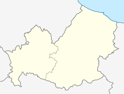
Ripabottoni is a comune (municipality) in the Province of Campobasso in the Italian region Molise, located about 20 kilometres (12 mi) northeast of Campobasso. As of 31 December 2004, it had a population of 644 and an area of 31.9 square kilometres (12.3 sq mi).[3]
Ripabottoni | |
|---|---|
| Comune di Ripabottoni | |
| Coordinates: 41°41′N 14°49′E / 41.683°N 14.817°E | |
| Country | Italy |
| Region | Molise |
| Province | Province of Campobasso (CB) |
| Area | |
• Total | 31.9 km2 (12.3 sq mi) |
| Elevation | 695 m (2,280 ft) |
| Population (Dec. 2004)[2] | |
• Total | 644 |
| • Density | 20/km2 (52/sq mi) |
| Time zone | UTC+1 (CET) |
| • Summer (DST) | UTC+2 (CEST) |
| Postal code | 86040 |
| Dialing code | 0874 |
Ripabottoni borders the following municipalities: Bonefro, Campolieto, Casacalenda, Monacilioni, Morrone del Sannio, Provvidenti, Sant'Elia a Pianisi.
Famous People from Ripabottoni
edit- Arturo Giovannitti, labor organizer in the United States, born in Ripabottoni
- Tony Volpentest, his paternal family came from Ripabottoni, the original name was Volpentesta.[4]
Transportation
editRipabottoni is served by a railway station, the Ripabottoni-S:Elia railway station, on the Termoli-Campobasso and Termoli–Venafro line.
Demographic evolution
edit
References
edit- ^ "Superficie di Comuni Province e Regioni italiane al 9 ottobre 2011". Italian National Institute of Statistics. Retrieved 16 March 2019.
- ^ "Popolazione Residente al 1° Gennaio 2018". Italian National Institute of Statistics. Retrieved 16 March 2019.
- ^ All demographics and other statistics: Italian statistical institute Istat.
- ^ Da Bebe a Zanardi, da Caironi a Tapia: quando i Fenomeni sono paralimpici gazzetta.it


