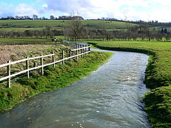
The River Og is a short river in Wiltshire, England.
| Og | |
|---|---|
 River Og, near Ogbourne St Andrew. | |
 | |
| Location | |
| Country | England |
| County | Wiltshire |
| Physical characteristics | |
| Source | |
| • location | Draycot Foliat, Swindon |
| • coordinates | 51°29′53″N 1°44′25″W / 51.49806°N 1.74028°W |
| Mouth | |
• location | Marlborough |
• coordinates | 51°25′13″N 1°43′43″W / 51.42028°N 1.72861°W |
| Length | 3.1 km (1.9 mi) |
It rises near the hamlet of Draycot Foliat, and flows south for about 3.1 km (1.9 miles) through Ogbourne St George, Ogbourne St Andrew and Ogbourne Maizey to the eastern edge of Marlborough, where it joins the River Kennet.[1]
The river flows through a gap in the Marlborough Downs, which creates a natural transport route, now followed by the A346 and once used by the Midland and South Western Junction Railway.
The Og's name is a back-formation from Ogbourne, which itself means Occa's stream.[2]
References
edit- ^ "River Og". Catchment Data Explorer. Environment Agency. Retrieved 19 December 2022.
- ^ Glover, J.E.B., Mawer, A. and Stenton, F.M. (1939) Place-names of Wiltshire, p.9