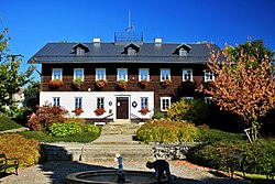
Rynoltice (German: Ringelshain) is a municipality and village in Liberec District in the Liberec Region of the Czech Republic. It has about 900 inhabitants.
Rynoltice | |
|---|---|
 Municipal office | |
| Coordinates: 50°47′21″N 14°49′8″E / 50.78917°N 14.81889°E | |
| Country | |
| Region | Liberec |
| District | Liberec |
| First mentioned | 1364 |
| Area | |
• Total | 17.72 km2 (6.84 sq mi) |
| Elevation | 340 m (1,120 ft) |
| Population (2024-01-01)[1] | |
• Total | 851 |
| • Density | 48/km2 (120/sq mi) |
| Time zone | UTC+1 (CET) |
| • Summer (DST) | UTC+2 (CEST) |
| Postal code | 463 53 |
| Website | www |
Administrative parts
editThe villages of Černá Louže, Jítrava, Nová Starost and Polesí are administrative parts of Rynoltice.
Geography
editRynoltice is located about 16 kilometres (10 mi) west of Liberec. It lies mostly in the Ralsko Uplands. The western part of the municipal territory extends into the Ještěd–Kozákov Ridge and includes the highest point of Rynoltice, the Vápenný mountain at 790 m (2,590 ft) above sea level. The stream Panenský potok originates on the slopes of Vápenný and flows across the municipality.
History
editThe first written mention of Rynoltice is from 1364. The village was founded in the 13th century by German colonists. During the Hussite Wars, the village was ransacked. It was resettled in 1563.[2]
Demographics
edit
|
|
| ||||||||||||||||||||||||||||||||||||||||||||||||||||||
| Source: Censuses[3][4] | ||||||||||||||||||||||||||||||||||||||||||||||||||||||||
Transport
editThe I/13 road (the section from Liberec to Děčín, which is a part of the European route E442) passes through the municipality.
Rynoltice is located on the railway line Liberec–Děčín.
Sights
editThe main landmark of Rynoltice is the Church of Saint Barbara. It dates from the second half of the 17th century. In the mid-18th century, it was modified to its present form.[5]
The Church of Saint Pancras is located in Jítrava. It was built in 1710 on the site of an older wooden church.[6]
Notable people
edit- Johann Schicht (1855–1907), German Bohemian entrepreneur
References
edit- ^ "Population of Municipalities – 1 January 2024". Czech Statistical Office. 2024-05-17.
- ^ "Historie" (in Czech). Obec Rynoltice. Retrieved 2021-08-16.
- ^ "Historický lexikon obcí České republiky 1869–2011" (in Czech). Czech Statistical Office. 2015-12-21.
- ^ "Population Census 2021: Population by sex". Public Database. Czech Statistical Office. 2021-03-27.
- ^ "Kostel sv. Barbory" (in Czech). National Heritage Institute. Retrieved 2024-02-22.
- ^ "Kostel sv. Pankráce" (in Czech). National Heritage Institute. Retrieved 2024-02-22.
External links
edit


