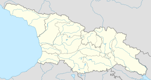
Samshvilde (Georgian: სამშვილდე, Armenian: Սամշվիլդե, also Շամշուլդա, Shamshulda)[2] is a village in the Tetritsqaro Municipality, Kvemo Kartli, Georgia. It is located 4 km south of the town of Tetritsqaro and 2 km north of the ruins of the medieval town of Samshvilde. The village was founded by a group of Armenians in the early 19th century and named after the nearby historical locale.[3]
Samshvilde
სამშვილდე | |
|---|---|
Village | |
 Samshvilde in 2010 | |
| Coordinates: 41°30′58″N 44°29′27″E / 41.51611°N 44.49083°E | |
| Country | |
| Region | Kvemo Kartli |
| Municipality | Tetritsqaro |
| Elevation | 860 m (2,820 ft) |
| Population (2014)[1] | |
• Total | 443 |
The environs of the village, on the middle Khrami River, are a protected area as the Samshvilde Canyon Natural Monument.[4]
Population
editAs of the 2014 national census, Samshvilde had the population of 443,[1] mostly (98%) ethnic Armenians.[5]
| Population | 2002 census | 2014 census |
|---|---|---|
| Total | 517[5] | 443[1] |
References
edit- ^ a b c "Population Census 2014: Number of Population by Administrative-Territorial Units and sex". National Statistics Office of Georgia. Retrieved 28 September 2016.
- ^ "Festival in Shamshulda Village". armenianchurch.ge. Diocese of the Armenian Apostolic Orthodox Holy Church in Georgia.
- ^ Volkova, NG (1984). "Материалы экономических обследований Кавказа 1880-х годов как этнографический источник" [Materials of economic surveys of the Caucasus of the 1880s as an ethnographic source]. Kavkazskiy Etnograficheskiy Sbornik (in Russian). VIII. Moscow: 220.
- ^ "სამშვილდის კანიონის ბუნების ძეგლი [Samshvilde Canyon Natural Monument]" (in Georgian). Agency of Protected Areas of Georgia. Retrieved 7 October 2016.
- ^ a b "საქართველოს მოსახლეობის 2002 წლის პირველი ეროვნული საყოველთაო აღწერის შედეგები, ტომი II [Results of the first national census of the population of Georgia in 2002, volume II]" (PDF) (in Georgian). National Statistics Office of Georgia. 2003. Retrieved 28 September 2016.
