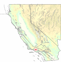
The San Cayetano Fault is an east-west trending thrust fault in Ventura County, Southern California. It stretches for 45 kilometers (28 mi), north of the city of Ventura, near the Topatopa Mountains, Piru, Fillmore, Santa Paula, Sulphur Springs, and Ojai.

Geology
editThe last known surface rupture was less than 5,000 years ago. Recent research indicates that the San Cayetano fault may have been the source of the December 21, 1812 earthquake.
Depending on location, the fault has an estimated slip rate between 1.3–9 millimeters (0.051–0.354 in). The recurrence rate between events is uncertain, but if the fault is associated with the 1812 event, it may be able to produce earthquakes approaching 6.5 – 7.3 in magnitude.
References
edit- Dolan, J. F.; Rockwell, T. K. (2001), "Paleoseismologic Evidence for a Very Large (Mw >7), Post-A.D. 1660 Surface Rupture on the Eastern San Cayetano Fault, Ventura County, California: Was This the Elusive Source of the Damaging 21 December 1812 Earthquake?", Bulletin of the Seismological Society of America, 91 (6): 1417–1432, Bibcode:2001BuSSA..91.1417D, doi:10.1785/0120000602
Further reading
edit- Hughes, A.; Rood, D.H.; Whittaker, A.C.; Bell, R.E.; Rockwell, T.K.; Levy, Y.; Wilcken, K.M.; Corbett, L.B.; Bierman, P.R.; DeVecchio, D.E.; Marshall, S.T.; Gurrola, L.D.; Nicholson, C. (2018). "Geomorphic evidence for the geometry and slip rate of a young, low-angle thrust fault: Implications for hazard assessment and fault interaction in complex tectonic environments". Earth and Planetary Science Letters. 504: 198–210. doi:10.1016/j.epsl.2018.10.003. hdl:10044/1/64539. ISSN 0012-821X.